Dombrot-sur-Vair | |
|---|---|
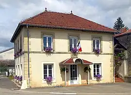 The town hall in Dombrot-sur-Vair | |
.svg.png.webp) Coat of arms | |
Location of Dombrot-sur-Vair | |
 Dombrot-sur-Vair  Dombrot-sur-Vair | |
| Coordinates: 48°15′56″N 5°53′20″E / 48.2656°N 5.8889°E | |
| Country | France |
| Region | Grand Est |
| Department | Vosges |
| Arrondissement | Neufchâteau |
| Canton | Vittel |
| Intercommunality | CC Terre d'eau |
| Government | |
| • Mayor (2020–2026) | Christophe Vouillon[1] |
| Area 1 | 9.04 km2 (3.49 sq mi) |
| Population | 242 |
| • Density | 27/km2 (69/sq mi) |
| Time zone | UTC+01:00 (CET) |
| • Summer (DST) | UTC+02:00 (CEST) |
| INSEE/Postal code | 88141 /88170 |
| Elevation | 310–399 m (1,017–1,309 ft) (avg. 360 m or 1,180 ft) |
| 1 French Land Register data, which excludes lakes, ponds, glaciers > 1 km2 (0.386 sq mi or 247 acres) and river estuaries. | |
Dombrot-sur-Vair (French pronunciation: [dɔ̃bʁo syʁ vɛʁ] ⓘ, literally Dombrot on Vair) is a commune in the Vosges department in Grand Est in northeastern France.
See also
References
- ↑ "Répertoire national des élus: les maires" (in French). data.gouv.fr, Plateforme ouverte des données publiques françaises. 13 September 2022.
- ↑ "Populations légales 2021". The National Institute of Statistics and Economic Studies. 28 December 2023.
Wikimedia Commons has media related to Dombrot-sur-Vair.
This article is issued from Wikipedia. The text is licensed under Creative Commons - Attribution - Sharealike. Additional terms may apply for the media files.