Saint-Remy | |
|---|---|
 Saint-Remy | |
.svg.png.webp) Coat of arms | |
Location of Saint-Remy | |
 Saint-Remy  Saint-Remy | |
| Coordinates: 48°20′52″N 6°49′42″E / 48.3478°N 6.8283°E | |
| Country | France |
| Region | Grand Est |
| Department | Vosges |
| Arrondissement | Saint-Dié-des-Vosges |
| Canton | Raon-l'Étape |
| Intercommunality | CA Saint-Dié-des-Vosges |
| Government | |
| • Mayor (2020–2026) | Claude George[1] |
| Area 1 | 12.25 km2 (4.73 sq mi) |
| Population | 520 |
| • Density | 42/km2 (110/sq mi) |
| Time zone | UTC+01:00 (CET) |
| • Summer (DST) | UTC+02:00 (CEST) |
| INSEE/Postal code | 88435 /88480 |
| Elevation | 317–524 m (1,040–1,719 ft) (avg. 350 m or 1,150 ft) |
| 1 French Land Register data, which excludes lakes, ponds, glaciers > 1 km2 (0.386 sq mi or 247 acres) and river estuaries. | |
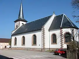
Saint-Remy (French pronunciation: [sɛ̃ ʁemi] ⓘ) is a commune in the Vosges department in Grand Est in northeastern France.
It is located on the D7, 4 km south-west of Étival-Clairefontaine.
See also
References
- ↑ "Répertoire national des élus: les maires". data.gouv.fr, Plateforme ouverte des données publiques françaises (in French). 2 December 2020.
- ↑ "Populations légales 2021". The National Institute of Statistics and Economic Studies. 28 December 2023.
Wikimedia Commons has media related to Saint-Remy (Vosges).
This article is issued from Wikipedia. The text is licensed under Creative Commons - Attribution - Sharealike. Additional terms may apply for the media files.