Saint-Sever-de-Saintonge | |
|---|---|
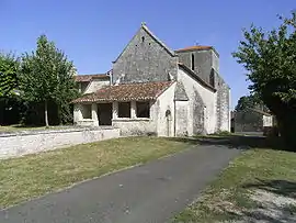 The church in Saint-Sever-de-Saintonge | |
Location of Saint-Sever-de-Saintonge | |
 Saint-Sever-de-Saintonge  Saint-Sever-de-Saintonge | |
| Coordinates: 45°41′41″N 0°30′25″W / 45.6947°N 0.5069°W | |
| Country | France |
| Region | Nouvelle-Aquitaine |
| Department | Charente-Maritime |
| Arrondissement | Saintes |
| Canton | Thénac |
| Intercommunality | CA Saintes |
| Government | |
| • Mayor (2020–2026) | Pierre Hervé[1] |
| Area 1 | 8.13 km2 (3.14 sq mi) |
| Population | 635 |
| • Density | 78/km2 (200/sq mi) |
| Time zone | UTC+01:00 (CET) |
| • Summer (DST) | UTC+02:00 (CEST) |
| INSEE/Postal code | 17400 /17800 |
| Elevation | 2–51 m (6.6–167.3 ft) (avg. 9 m or 30 ft) |
| 1 French Land Register data, which excludes lakes, ponds, glaciers > 1 km2 (0.386 sq mi or 247 acres) and river estuaries. | |
Saint-Sever-de-Saintonge is a commune in the Charente-Maritime department in southwestern France.
Population
| Year | Pop. | ±% |
|---|---|---|
| 1962 | 419 | — |
| 1968 | 484 | +15.5% |
| 1975 | 462 | −4.5% |
| 1982 | 431 | −6.7% |
| 1990 | 511 | +18.6% |
| 1999 | 588 | +15.1% |
| 2008 | 612 | +4.1% |
See also
References
- ↑ "Répertoire national des élus: les maires". data.gouv.fr, Plateforme ouverte des données publiques françaises (in French). 2 December 2020.
- ↑ "Populations légales 2021". The National Institute of Statistics and Economic Studies. 28 December 2023.
External links
 Media related to Saint-Sever-de-Saintonge at Wikimedia Commons
This article is issued from Wikipedia. The text is licensed under Creative Commons - Attribution - Sharealike. Additional terms may apply for the media files.