Sainte-Ramée | |
|---|---|
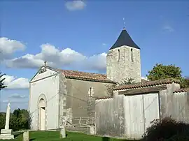 The church in Sainte-Ramée | |
Location of Sainte-Ramée | |
 Sainte-Ramée  Sainte-Ramée | |
| Coordinates: 45°25′28″N 0°39′36″W / 45.4244°N 0.66°W | |
| Country | France |
| Region | Nouvelle-Aquitaine |
| Department | Charente-Maritime |
| Arrondissement | Jonzac |
| Canton | Pons |
| Government | |
| • Mayor (2020–2026) | Fabrice Olivier[1] |
| Area 1 | 4.67 km2 (1.80 sq mi) |
| Population | 114 |
| • Density | 24/km2 (63/sq mi) |
| Time zone | UTC+01:00 (CET) |
| • Summer (DST) | UTC+02:00 (CEST) |
| INSEE/Postal code | 17390 /17240 |
| Elevation | 8–80 m (26–262 ft) |
| 1 French Land Register data, which excludes lakes, ponds, glaciers > 1 km2 (0.386 sq mi or 247 acres) and river estuaries. | |
Sainte-Ramée (French pronunciation: [sɛ̃t ʁame]) is a commune in the Charente-Maritime department in the Nouvelle-Aquitaine region in southwestern France.
Population
| Year | Pop. | ±% |
|---|---|---|
| 1962 | 161 | — |
| 1968 | 186 | +15.5% |
| 1975 | 181 | −2.7% |
| 1982 | 175 | −3.3% |
| 1990 | 144 | −17.7% |
| 1999 | 126 | −12.5% |
| 2008 | 129 | +2.4% |
See also
References
- ↑ "Répertoire national des élus: les maires" (in French). data.gouv.fr, Plateforme ouverte des données publiques françaises. 13 September 2022.
- ↑ "Populations légales 2021". The National Institute of Statistics and Economic Studies. 28 December 2023.
External links
 Media related to Sainte-Ramée at Wikimedia Commons
This article is issued from Wikipedia. The text is licensed under Creative Commons - Attribution - Sharealike. Additional terms may apply for the media files.