Varzi | |
|---|---|
| Comune di Varzi | |
 | |
Location of Varzi | |
 Varzi Location of Varzi in Italy 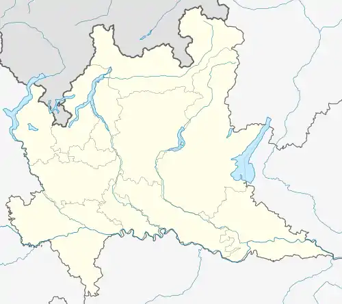 Varzi Varzi (Lombardy) | |
| Coordinates: 44°49′N 9°12′E / 44.817°N 9.200°E | |
| Country | Italy |
| Region | Lombardy |
| Province | Pavia (PV) |
| Frazioni | Bognassi, Bosmenso, Casa Bertella, Castellaro, Cella, Monteforte, Nivione, Pietragavina, Rosara, Sagliano, Santa Cristina |
| Government | |
| • Mayor | Gianfranco Alberti |
| Area | |
| • Total | 57.61 km2 (22.24 sq mi) |
| Elevation | 426 m (1,398 ft) |
| Population (1 January 2013)[2] | |
| • Total | 3,383 |
| • Density | 59/km2 (150/sq mi) |
| Demonym | Varzesi |
| Time zone | UTC+1 (CET) |
| • Summer (DST) | UTC+2 (CEST) |
| Postal code | 27057 |
| Dialing code | 0383 |
| Website | Official website |
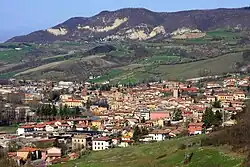
Varzi is a comune (municipality) in the Province of Pavia in the Italian region Lombardy, located about 70 km south of Milan and about 40 km south of Pavia. It is one of I Borghi più belli d'Italia ("The most beautiful villages of Italy").[3]
Varzi borders the following municipalities: Bagnaria, Fabbrica Curone, Gremiasco, Menconico, Ponte Nizza, Romagnese, Santa Margherita di Staffora, Val di Nizza, Valverde, Zavattarello.
Main sights
Among the religious buildings in town are:
References
- ↑ "Superficie di Comuni Province e Regioni italiane al 9 ottobre 2011". Italian National Institute of Statistics. Retrieved 16 March 2019.
- ↑ All demographics and other statistics: Italian statistical institute Istat.
- ↑ "Lombardia" (in Italian). Retrieved 31 July 2023.
External links
This article is issued from Wikipedia. The text is licensed under Creative Commons - Attribution - Sharealike. Additional terms may apply for the media files.