| Vestal Peak | |
|---|---|
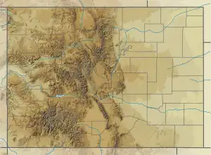
Vestal Peak centered in the distance (Arrow Peak to the right) | |
| Highest point | |
| Elevation | 13,870 ft (4,228 m)[1][2] |
| Prominence | 1,124 ft (343 m)[2] |
| Isolation | 4.29 mi (6.90 km)[2] |
| Listing | Colorado range high points |
| Coordinates | 37°41′22″N 107°36′09″W / 37.6894429°N 107.6025603°W[3] |
| Geography | |
 Vestal Peak | |
| Location | San Juan County, Colorado, U.S.[3] |
| Parent range | San Juan Mountains, Needle Mountains, Highest summit of the Grenadier Range[2] |
| Topo map | USGS 7.5' topographic map Storm King Peak, Colorado[3] |
| Climbing | |
| Easiest route | hike, exposed scramble |
Vestal Peak, elevation 13,870 ft (4,230 m), is a summit in the Needle Mountains of southwest Colorado. The peak is southeast of Silverton in the Weminuche Wilderness.
See also
References
- ↑ The elevation of Vestal Peak includes an adjustment of +1.781 m (+5.84 ft) from NGVD 29 to NAVD 88.
- 1 2 3 4 "Vestal Peak, Colorado". Peakbagger.com. Retrieved October 22, 2014.
- 1 2 3 "Vestal Peak". Geographic Names Information System. United States Geological Survey, United States Department of the Interior. Retrieved October 22, 2014.
External links
Denver (capital) | |
| Topics |
|
| Society | |
| Cities |
|
| Counties |
|
| Regions |
|
| Federal |
| ||||||||||||||||||||||||||||||||
|---|---|---|---|---|---|---|---|---|---|---|---|---|---|---|---|---|---|---|---|---|---|---|---|---|---|---|---|---|---|---|---|---|---|
| State |
| ||||||||||||||||||||||||||||||||
| Trails |
| ||||||||||||||||||||||||||||||||
This article is issued from Wikipedia. The text is licensed under Creative Commons - Attribution - Sharealike. Additional terms may apply for the media files.