A Teixeira/La Teijeira | |
|---|---|
municipality | |
 Seal | |
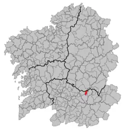 Location in Galicia | |
 A Teixeira/La Teijeira Location in Spain | |
| Coordinates: 42°23′30″N 7°28′27″W / 42.39167°N 7.47417°W | |
| Country | |
| Autonomous community | |
| Province | |
| Comarca | Terra de Caldelas |
| Government | |
| • Mayor | Miguel Antonio Cid Álvarez (People's Party) |
| Area | |
| • Total | 27.6 km2 (10.7 sq mi) |
| Elevation | 593 m (1,946 ft) |
| Population (2018)[2] | |
| • Total | 332 |
| • Density | 12/km2 (31/sq mi) |
| Time zone | UTC+1 (CET) |
| • Summer (DST) | UTC+2 (CEST) |
| Website | www.concelloateixeira.org |
La Teijeira is a municipality in Ourense in the Galicia region of north-west Spain. It is in the very north of the province. In 2008, it had a population of 505.[3]
References
- ↑ "IGE. Táboas". www.ige.eu (in Galician). Retrieved 2017-10-11.
- ↑ Municipal Register of Spain 2018. National Statistics Institute.
- ↑ "Población, superficie y densidad por municipios". Instituto Nacional de Estadística (in Spanish). Archived from the original on 2011-06-04. Retrieved 2009-11-12.
This article is issued from Wikipedia. The text is licensed under Creative Commons - Attribution - Sharealike. Additional terms may apply for the media files.