Arlebosc | |
|---|---|
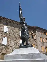 Statue of Joan of Arc at Arlebosc | |
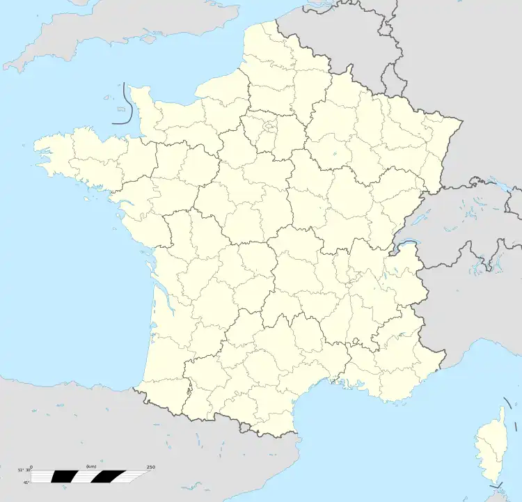
Location of Arlebosc | |
  Arlebosc 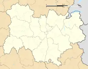 Arlebosc | |
| Coordinates: 45°02′14″N 4°39′07″E / 45.0372°N 4.6519°E | |
| Country | France |
| Region | Auvergne-Rhône-Alpes |
| Department | Ardèche |
| Arrondissement | Tournon-sur-Rhône |
| Canton | Haut-Vivarais |
| Intercommunality | CA Arche Agglo |
| Government | |
| • Mayor (2020–2026) | Michel Gay[1] |
| Area 1 | 12.35 km2 (4.77 sq mi) |
| Population | 342 |
| • Density | 28/km2 (72/sq mi) |
| Time zone | UTC+01:00 (CET) |
| • Summer (DST) | UTC+02:00 (CEST) |
| INSEE/Postal code | 07014 /07410 |
| Elevation | 265–1,028 m (869–3,373 ft) (avg. 420 m or 1,380 ft) |
| 1 French Land Register data, which excludes lakes, ponds, glaciers > 1 km2 (0.386 sq mi or 247 acres) and river estuaries. | |
Arlebosc (French pronunciation: [aʁləbɔsk]; Occitan: Arlabòsc) is a commune in the Ardèche department in the Auvergne-Rhône-Alpes region of southern France.
The inhabitants of the commune are known as Arleboscois or Arleboscoises[3]
Geography
Arlebosc is located some 12 km west by south-west of Tournon-sur-Rhône and 8 km north-east of Lamastre. Access to the commune is by the D578 road from Saint-Jeure-d'Ay in the north passing through the village and continuing west then south-west to join the D534 north-west of Lamastre. Apart from the village there are the hamlets of Saint-Just in the north-east and Les Fauries in the western extension of the commune. The commune is rugged and heavily forested with some farmland on the eastern side.[4]
The Doux river forms part of the south-western border and flows through the commune from south-west to north-east. The Ruisseau de Balaye forms the western border as it flows south to join the Doux. Other streams rise in the commune and flow south-east to join the Doux. The Merdenc rises in the north of the commune and forms part of the northern border as it flows north-east to join the Daronne south-east of Saint-Félicien.[4]
Neighbouring communes and villages
Places adjacent to Arlebosc | |
|---|---|


Toponymy
A legend attributes the name of the commune to one of its Lords: Bozon d'Arles.
In reality, it is a name from the Old French -bosc (a primitive form of bois meaning "wood") attested in the Occitan form of Arlabosc from 912 and Latinized to Allabosco in the 14th century.[5]
Ernest Nègre[5] explained the first element as an Occitan form erela meaning "cranberry". The French term for cranberry (Airelle) is considered to be a borrowing from a variant of the Massif Central or the Alpine éiréla (also airelo). The Provençal aire is also used for "cranberry", from the Latin ater meaning "black",[6] d'où la signification globale de « bois des airelles ».3, so the overall meaning is "forest of cranberries".
Administration
List of Successive Mayors[7]
| From | To | Name |
|---|---|---|
| 1809 | Jean-Baptiste Bouvet | |
| 1809 | 1816 | Jean André Etienne-Peyrouze |
| 1817 | Jean Alexandre du Rouchet de Chazotte | |
| 1945 | 1954 | Marius Sarzier |
| 1954 | 1977 | André Banchet |
| 1977 | 1989 | Michel Vert |
| 1989 | 2008 | Jean-Claude Deloche |
| 2008 | 2020 | Jean Paul Agier |
| 2020 | current | Michel Gay |
Demography
In 2017 the commune had 331 inhabitants.[8]
|
| ||||||||||||||||||||||||||||||||||||||||||||||||||||||||||||||||||||||||||||||||||||||||||||||||||||||||||||||||||
| Source: EHESS[9] and INSEE[8] | |||||||||||||||||||||||||||||||||||||||||||||||||||||||||||||||||||||||||||||||||||||||||||||||||||||||||||||||||||
Distribution of Age Groups
The population of the town is older than the departmental average.
Percentage Distribution of Age Groups in Arlebosc and Ardèche Department in 2017
| Arlebosc | Ardèche | |||
|---|---|---|---|---|
| Age Range | Men | Women | Men | Women |
| 0 to 14 Years | 13.6 | 13.0 | 17.7 | 16.1 |
| 15 to 29 Years | 9.3 | 11.8 | 14.4 | 13.0 |
| 30 to 44 Years | 14.8 | 14.8 | 17.3 | 16.9 |
| 45 to 59 Years | 22.2 | 23.1 | 21.6 | 20.7 |
| 60 to 74 Years | 29.0 | 20.1 | 19.7 | 19.7 |
| 75 to 89 Years | 9.9 | 16.6 | 8.5 | 11.2 |
| 90 Years+ | 1.2 | 0.6 | 0.9 | 2.4 |
Sites and Monuments
- The Chateau of Chazotte (17th century)
 is registered as an historical monument.[11]
 - The Chateau of Malgaray
- The Chateau of Romaneaux
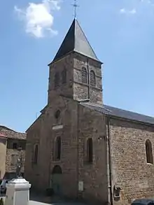
- The Church of Saint Sacrement from the 19th century. The church contains several items that are registered as historical objects:
- The Chapel of Saint Just

Picture Gallery
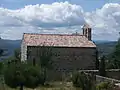 Chapel at Saint Just
.jpg.webp) Tincey Cross from 1890
Tincey Cross from 1890.jpg.webp) Cross in front of the Chapel at Saint Just
Cross in front of the Chapel at Saint Just
Notable people linked to the commune
- Myriam Gagnaire, a presenter on France 3 and TV5 Monde on "Side gardens" is a resident of the commune and artistic director of http://www.lacompagnieduchatquilouche.fr Archived 2019-02-12 at the Wayback Machine, a cultural association whose headquarters is in Arlebosc and covers the Ardèche department with various cultural and educational activities in association with the local authorities.
See also
References
- ↑ "Répertoire national des élus: les maires". data.gouv.fr, Plateforme ouverte des données publiques françaises (in French). 2 December 2020.
- ↑ "Populations légales 2021". The National Institute of Statistics and Economic Studies. 28 December 2023.
- ↑ Inhabitants of Ardèche (in French)
- 1 2 3 Google Maps
- 1 2 Ernest Nègre, Toponymie générale de la France, volume II, Librairie Droz, 1991. p. 1206. (in French)
- ↑ Etymology of airelle, CNRTL website (in French)
- ↑ List of Mayors of France (in French)
- 1 2 3 Évolution et structure de la population en 2017: Commune d'Arlebosc (07014)
- ↑ Des villages de Cassini aux communes d'aujourd'hui: Commune data sheet Arlebosc, EHESS (in French).
- ↑ Évolution et structure de la population en 2017: Département de l'Ardèche (07)
- ↑ Ministry of Culture, Mérimée PA00116627 Chateau of Chazotte (in French)

- ↑ Ministry of Culture, Palissy PM07001092 Statue: Torch-bearing Angels (in French)
- ↑ Ministry of Culture, Palissy PM07000029 Silk Cope (in French)
- ↑ Ministry of Culture, Palissy PM07000028 Group Sculpture: Crucifixion (in French)
- ↑ Ministry of Culture, Palissy PM07000027 Ciborium (in French)
External links
- Arlebosc on the National Geographic Institute website (in French)
- Arlebosc on Géoportail, National Geographic Institute (IGN) website (in French)
- Arlebosc on the 1750 Cassini Map