Boulieu-lès-Annonay | |
|---|---|
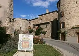 The road into Boulieu-lès-Annonay | |
.svg.png.webp) Coat of arms | |
Location of Boulieu-lès-Annonay | |
 Boulieu-lès-Annonay  Boulieu-lès-Annonay | |
| Coordinates: 45°16′18″N 4°40′02″E / 45.2717°N 4.6672°E | |
| Country | France |
| Region | Auvergne-Rhône-Alpes |
| Department | Ardèche |
| Arrondissement | Tournon-sur-Rhône |
| Canton | Annonay-1 |
| Intercommunality | Annonay Rhône Agglo |
| Government | |
| • Mayor (2020–2026) | Damien Bayle[1] |
| Area 1 | 9.45 km2 (3.65 sq mi) |
| Population | 2,294 |
| • Density | 240/km2 (630/sq mi) |
| Time zone | UTC+01:00 (CET) |
| • Summer (DST) | UTC+02:00 (CEST) |
| INSEE/Postal code | 07041 /07100 |
| Elevation | 358–915 m (1,175–3,002 ft) |
| 1 French Land Register data, which excludes lakes, ponds, glaciers > 1 km2 (0.386 sq mi or 247 acres) and river estuaries. | |
Boulieu-lès-Annonay (French pronunciation: [buljø lɛ.z‿anɔnɛ], literally Boulieu near Annonay; Occitan: Bonluòc) is a commune in the Ardèche department in southern France.
Population
| Year | Pop. | ±% p.a. |
|---|---|---|
| 1968 | 1,459 | — |
| 1975 | 1,666 | +1.91% |
| 1982 | 1,767 | +0.84% |
| 1990 | 1,942 | +1.19% |
| 1999 | 2,096 | +0.85% |
| 2007 | 2,075 | −0.13% |
| 2012 | 2,163 | +0.83% |
| 2017 | 2,300 | +1.24% |
| Source: INSEE[3] | ||
See also
References
- ↑ "Répertoire national des élus: les maires" (in French). data.gouv.fr, Plateforme ouverte des données publiques françaises. 13 September 2022.
- ↑ "Populations légales 2021". The National Institute of Statistics and Economic Studies. 28 December 2023.
- ↑ Population en historique depuis 1968, INSEE
Wikimedia Commons has media related to Boulieu-lès-Annonay.
This article is issued from Wikipedia. The text is licensed under Creative Commons - Attribution - Sharealike. Additional terms may apply for the media files.