Caapiranga | |
|---|---|
Municipality | |
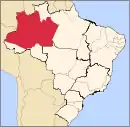
.PNG.webp) Location of the municipality inside Amazonas | |
 Location in Brazil | |
| Coordinates: 3°19′39″S 61°12′32″W / 3.32750°S 61.20889°W | |
| Country | |
| Region | North |
| State | |
| Area | |
| • Total | 9,457 km2 (3,651 sq mi) |
| Population (2020) | |
| • Total | 13,283 |
| • Density | 1.1/km2 (3/sq mi) |
| Time zone | UTC−4 (AMT) |
| Climate | Af |
Caapiranga is a municipality located in the Brazilian state of Amazonas. Its population was 13,283 (2020)[1] and its area is 9,457 km².[2]
References
- ↑ IBGE 2020
- ↑ IBGE - "Archived copy". Archived from the original on 2008-06-11. Retrieved 2008-06-11.
{{cite web}}: CS1 maint: archived copy as title (link)
Capital: Manaus | ||||||||||||||
| Mesoregion Centro Amazonense |
|  | ||||||||||||
| Mesoregion Norte Amazonense |
| |||||||||||||
| Mesoregion Sudoeste Amazonense |
| |||||||||||||
| Mesoregion Sul Amazonense |
| |||||||||||||
This article is issued from Wikipedia. The text is licensed under Creative Commons - Attribution - Sharealike. Additional terms may apply for the media files.