Santo Antônio do Içá | |
|---|---|
 Flag | |
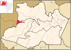 Location in Amazonas state | |
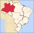
 Santo Antônio do Içá Location in Brazil | |
| Coordinates: 3°6′7″S 67°56′24″W / 3.10194°S 67.94000°W | |
| Country | Brazil |
| Region | North |
| State | Amazonas |
| Microregion | Alto Solimões |
| Area | |
| • Total | 12,307 km2 (4,752 sq mi) |
| Population (2020) | |
| • Total | 21,243 |
| • Density | 1.7/km2 (4.5/sq mi) |
| Time zone | UTC−4 (AMT) |
| Postal code | 69680-xxx |
| Area code | +55 97 |
Santo Antônio do Içá is a community and a municipality in the state of Amazonas near the Colombian border in Brazil. The population is 21,243 (2020 est.)[1] in an area of 12,307 km².[2] The municipality was created in 1955 out of São Paulo de Olivença. The city is served by Ipiranga Airport.
The municipality contains the 15,000 hectares (37,000 acres) Javari-Buriti Area of Relevant Ecological Interest, created in 1985.[3] It contains parts of the Jutaí-Solimões Ecological Station.[4]
References
- ↑ IBGE 2020
- ↑ Instituto Brasileiro de Geografia e Estatística
- ↑ ARIE Javari-Buriti (in Portuguese), ISA: Instituto Socioambiental, retrieved 2016-10-19
- ↑ Unidade de Conservação: Estação Ecológica de Jutaí-Solimões (in Portuguese), MMA: Ministério do Meio Ambiente, retrieved 2016-05-04
External links
- (in Portuguese) Santo Antônio do Içá on citybrazil.com.br
Capital: Manaus | ||||||||||||||
| Mesoregion Centro Amazonense |
|  | ||||||||||||
| Mesoregion Norte Amazonense |
| |||||||||||||
| Mesoregion Sudoeste Amazonense |
| |||||||||||||
| Mesoregion Sul Amazonense |
| |||||||||||||
This article is issued from Wikipedia. The text is licensed under Creative Commons - Attribution - Sharealike. Additional terms may apply for the media files.