Carves | |
|---|---|
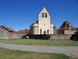 The church in Carves | |
 Coat of arms | |
Location of Carves | |
 Carves  Carves | |
| Coordinates: 44°47′13″N 1°03′58″E / 44.7869°N 1.0661°E | |
| Country | France |
| Region | Nouvelle-Aquitaine |
| Department | Dordogne |
| Arrondissement | Sarlat-la-Canéda |
| Canton | Vallée Dordogne |
| Government | |
| • Mayor (2020–2026) | Maryvonne Chaumel[1] |
| Area 1 | 10.13 km2 (3.91 sq mi) |
| Population | 103 |
| • Density | 10/km2 (26/sq mi) |
| Time zone | UTC+01:00 (CET) |
| • Summer (DST) | UTC+02:00 (CEST) |
| INSEE/Postal code | 24084 /24170 |
| Elevation | 87–262 m (285–860 ft) (avg. 240 m or 790 ft) |
| 1 French Land Register data, which excludes lakes, ponds, glaciers > 1 km2 (0.386 sq mi or 247 acres) and river estuaries. | |
Carves (French pronunciation: [kaʁv]; Occitan: Carvas) is a commune in the Dordogne department in Nouvelle-Aquitaine in southwestern France.
Population
| Year | Pop. | ±% p.a. |
|---|---|---|
| 1968 | 153 | — |
| 1975 | 148 | −0.47% |
| 1982 | 138 | −0.99% |
| 1990 | 131 | −0.65% |
| 1999 | 112 | −1.73% |
| 2009 | 112 | +0.00% |
| 2014 | 106 | −1.10% |
| 2020 | 104 | −0.32% |
| Source: INSEE[3] | ||
See also
References
- ↑ "Répertoire national des élus: les maires". data.gouv.fr, Plateforme ouverte des données publiques françaises (in French). 2 December 2020.
- ↑ "Populations légales 2021". The National Institute of Statistics and Economic Studies. 28 December 2023.
- ↑ Population en historique depuis 1968, INSEE
Wikimedia Commons has media related to Carves (Dordogne).
This article is issued from Wikipedia. The text is licensed under Creative Commons - Attribution - Sharealike. Additional terms may apply for the media files.