La Chapelle-Montmoreau | |
|---|---|
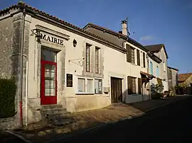 The town hall in La Chapelle-Montmoreau | |
Location of La Chapelle-Montmoreau | |
 La Chapelle-Montmoreau  La Chapelle-Montmoreau | |
| Coordinates: 45°26′58″N 0°38′37″E / 45.4494°N 0.6436°E | |
| Country | France |
| Region | Nouvelle-Aquitaine |
| Department | Dordogne |
| Arrondissement | Nontron |
| Canton | Brantôme en Périgord |
| Government | |
| • Mayor (2020–2026) | Alain Peyrou[1] |
| Area 1 | 8.09 km2 (3.12 sq mi) |
| Population | 74 |
| • Density | 9.1/km2 (24/sq mi) |
| Time zone | UTC+01:00 (CET) |
| • Summer (DST) | UTC+02:00 (CEST) |
| INSEE/Postal code | 24111 /24300 |
| Elevation | 150–226 m (492–741 ft) (avg. 179 m or 587 ft) |
| 1 French Land Register data, which excludes lakes, ponds, glaciers > 1 km2 (0.386 sq mi or 247 acres) and river estuaries. | |
La Chapelle-Montmoreau (French pronunciation: [la ʃapɛl mɔ̃mɔʁo]; Occitan: La Chapela de Montmaurelh) is a commune in the Dordogne department in Nouvelle-Aquitaine in southwestern France.
Population
| Year | Pop. | ±% |
|---|---|---|
| 1962 | 96 | — |
| 1968 | 85 | −11.5% |
| 1975 | 79 | −7.1% |
| 1982 | 88 | +11.4% |
| 1990 | 87 | −1.1% |
| 1999 | 91 | +4.6% |
| 2008 | 75 | −17.6% |
See also
References
- ↑ "Répertoire national des élus: les maires". data.gouv.fr, Plateforme ouverte des données publiques françaises (in French). 2 December 2020.
- ↑ "Populations légales 2021". The National Institute of Statistics and Economic Studies. 28 December 2023.
Wikimedia Commons has media related to La Chapelle-Montmoreau.
This article is issued from Wikipedia. The text is licensed under Creative Commons - Attribution - Sharealike. Additional terms may apply for the media files.