Clumanc | |
|---|---|
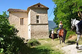 Chateau | |
 Coat of arms | |
Location of Clumanc | |
 Clumanc 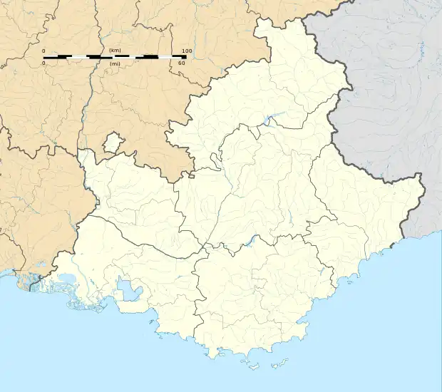 Clumanc | |
| Coordinates: 44°01′28″N 6°23′02″E / 44.0244°N 6.3839°E | |
| Country | France |
| Region | Provence-Alpes-Côte d'Azur |
| Department | Alpes-de-Haute-Provence |
| Arrondissement | Castellane |
| Canton | Riez |
| Intercommunality | Alpes Provence Verdon - Sources de Lumière |
| Government | |
| • Mayor (2020–2026) | Thierry Viale[1] |
| Area 1 | 53.68 km2 (20.73 sq mi) |
| Population | 221 |
| • Density | 4.1/km2 (11/sq mi) |
| Time zone | UTC+01:00 (CET) |
| • Summer (DST) | UTC+02:00 (CEST) |
| INSEE/Postal code | 04059 /04330 |
| Elevation | 773–1,703 m (2,536–5,587 ft) (avg. 800 m or 2,600 ft) |
| 1 French Land Register data, which excludes lakes, ponds, glaciers > 1 km2 (0.386 sq mi or 247 acres) and river estuaries. | |
Clumanc (French pronunciation: [klymɑ̃k]) is a commune in the Alpes-de-Haute-Provence department in southeastern France.
Geography
The river Asse de Clumanc flows south through the commune.
Population
| Year | Pop. | ±% p.a. |
|---|---|---|
| 1968 | 177 | — |
| 1975 | 135 | −3.80% |
| 1982 | 137 | +0.21% |
| 1990 | 156 | +1.64% |
| 1999 | 154 | −0.14% |
| 2009 | 176 | +1.34% |
| 2014 | 197 | +2.28% |
| 2020 | 221 | +1.93% |
| Source: INSEE[3] | ||
See also
References
- ↑ "Répertoire national des élus: les maires". data.gouv.fr, Plateforme ouverte des données publiques françaises (in French). 2 December 2020.
- ↑ "Populations légales 2021". The National Institute of Statistics and Economic Studies. 28 December 2023.
- ↑ Population en historique depuis 1968, INSEE
Wikimedia Commons has media related to Clumanc.
This article is issued from Wikipedia. The text is licensed under Creative Commons - Attribution - Sharealike. Additional terms may apply for the media files.