El Sahugo | |
|---|---|
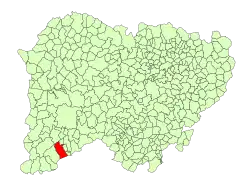 Location in Salamanca | |
| Coordinates: 40°24′51″N 6°32′39″W / 40.41417°N 6.54417°W | |
| Country | Spain |
| Autonomous community | Castile and León |
| Province | Salamanca |
| Comarca | Comarca de Ciudad Rodrigo |
| Subcomarca | Los Agadones |
| Government | |
| • Mayor | Agustín Tome Oreja (People's Party) |
| Area | |
| • Total | 59 km2 (23 sq mi) |
| Elevation | 823 m (2,700 ft) |
| Population (2018)[2] | |
| • Total | 193 |
| • Density | 3.3/km2 (8.5/sq mi) |
| Time zone | UTC+1 (CET) |
| • Summer (DST) | UTC+2 (CEST) |
| Postal code | 37510 |
El Sahugo is a village and municipality in the province of Salamanca, western Spain, part of the autonomous community of Castile-Leon. It is located 109 kilometres (68 mi) from the provincial capital city of Salamanca and has a population of 196 people as of 2016.[3]
Geography
The municipality covers an area of 59 km2 (23 sq mi). It lies 823 metres (2,700 ft) above sea level and the postal code is 37514.
Economy
- The basis of the economy is agriculture.
See also
References
- 1 2 "Municipio:Sahúgo (El)". www.lasalina.es. Retrieved 2017-11-03.
- ↑ Municipal Register of Spain 2018. National Statistics Institute.
- ↑ "Salamanca: Población por municipios y sexo". www.ine.es (in Spanish). Retrieved 2017-11-03.
This article is issued from Wikipedia. The text is licensed under Creative Commons - Attribution - Sharealike. Additional terms may apply for the media files.