La Fregeneda | |
|---|---|
_01.jpg.webp) | |
 Flag  Seal | |
 Location in Salamanca | |
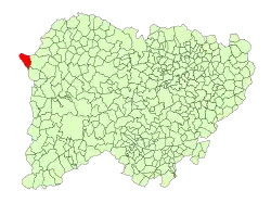
 La Fregeneda  La Fregeneda | |
| Coordinates: 40°59′16″N 6°52′02″W / 40.98778°N 6.86722°W | |
| Country | Spain |
| Autonomous community | Castile and León |
| Province | Salamanca |
| Comarca | El Abadengo |
| Government | |
| • Mayor | Bernardo García Trigo (People's Party) |
| Area | |
| • Total | 45 km2 (17 sq mi) |
| Elevation | 527 m (1,729 ft) |
| Population (2018)[2] | |
| • Total | 362 |
| • Density | 8.0/km2 (21/sq mi) |
| Time zone | UTC+1 (CET) |
| • Summer (DST) | UTC+2 (CEST) |
| Postal code | 37220 |
La Fregeneda is a municipality of Spain located in the province of Salamanca, Castile and León. As of 2016 the municipality has a population of 337 inhabitants.[3]
See also
References
- 1 2 "Municipio:Fregeneda (La)". www.lasalina.es. Retrieved 2017-11-04.
- ↑ Municipal Register of Spain 2018. National Statistics Institute.
- ↑ "Salamanca: Población por municipios y sexo". www.ine.es (in Spanish). Retrieved 2017-11-04.
This article is issued from Wikipedia. The text is licensed under Creative Commons - Attribution - Sharealike. Additional terms may apply for the media files.