Epiry | |
|---|---|
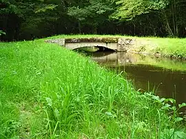 Stone bridge over the Yonne tributary | |
Location of Epiry | |
 Epiry  Epiry | |
| Coordinates: 47°11′01″N 3°43′24″E / 47.1836°N 3.7233°E | |
| Country | France |
| Region | Bourgogne-Franche-Comté |
| Department | Nièvre |
| Arrondissement | Clamecy |
| Canton | Corbigny |
| Government | |
| • Mayor (2020–2026) | Marie-Thérèse Thomas[1] |
| Area 1 | 12.13 km2 (4.68 sq mi) |
| Population | 233 |
| • Density | 19/km2 (50/sq mi) |
| Time zone | UTC+01:00 (CET) |
| • Summer (DST) | UTC+02:00 (CEST) |
| INSEE/Postal code | 58110 /58800 |
| Elevation | 217–397 m (712–1,302 ft) |
| 1 French Land Register data, which excludes lakes, ponds, glaciers > 1 km2 (0.386 sq mi or 247 acres) and river estuaries. | |
Epiry (French pronunciation: [epiʁi]) is a commune in the Nièvre department in central France.[3]
Demographics
In January of 2020, the estimated population was 239.
See also
References
- ↑ "Répertoire national des élus: les maires". data.gouv.fr, Plateforme ouverte des données publiques françaises (in French). 2 December 2020.
- ↑ "Populations légales 2021". The National Institute of Statistics and Economic Studies. 28 December 2023.
- ↑ INSEE commune file
Wikimedia Commons has media related to Epiry.
This article is issued from Wikipedia. The text is licensed under Creative Commons - Attribution - Sharealike. Additional terms may apply for the media files.