| Fatigue Mountain | |
|---|---|
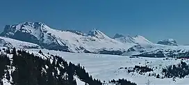 Northwest aspect, centre | |
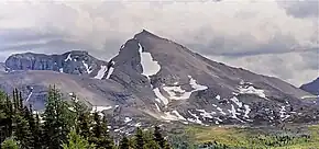
| Highest point | |
| Elevation | 2,950 m (9,680 ft)[1] |
| Prominence | 556 m (1,824 ft)[2] |
| Parent peak | Nasswald Peak 3042 m[2] |
| Listing | Mountains of Alberta |
| Coordinates | 51°01′42″N 115°41′37″W / 51.02833°N 115.69361°W[3] |
| Geography | |
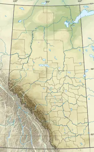 Fatigue Mountain Location in Alberta and British Columbia  Fatigue Mountain Fatigue Mountain (British Columbia) | |
| Country | Canada |
| Provinces | Alberta and British Columbia |
| Parent range | Continental Ranges[2] |
| Topo map | NTS 82O4 Banff |
| Climbing | |
| First ascent | 1888 by W.S. Drewry |
Fatigue Mountain is located on the border of Alberta and British Columbia on the Continental Divide[1][2]The mountain was named in 1888 by W.S. Drewry who became fatigued on the first ascent.[1][4]
Climate
Based on the Köppen climate classification, Fatigue Mountain is located in a subarctic climate zone with cold, snowy winters, and mild summers.[5] Winter temperatures can drop below -20 °C with wind chill factors below -30 °C.
See also
Fatigue Mountain
References
- 1 2 3 "Fatigue Mountain". cdnrockiesdatabases.ca. Retrieved 2019-08-19.
- 1 2 3 4 "Fatigue Mountain". Bivouac.com. Retrieved 2019-08-19.
- ↑ "Fatigue Mountain". Geographical Names Data Base. Natural Resources Canada. Retrieved 2019-08-19.
- ↑ "Place-names of Alberta". babel.hathitrust.org. Geographical Names Board of Canada. Retrieved 2019-08-19.
- ↑ Peel, M. C.; Finlayson, B. L. & McMahon, T. A. (2007). "Updated world map of the Köppen−Geiger climate classification". Hydrol. Earth Syst. Sci. 11: 1633–1644. ISSN 1027-5606.
External links
This article is issued from Wikipedia. The text is licensed under Creative Commons - Attribution - Sharealike. Additional terms may apply for the media files.