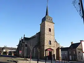
Fercé
| |
|---|---|
Commune | |
 | |
.svg.png.webp) Coat of arms | |
Location of Fercé | |
 Fercé 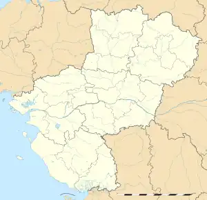 Fercé | |
| Coordinates: 47°47′49″N 1°24′51″W / 47.7969°N 1.4142°W | |
| Country | France |
| Region | Pays de la Loire |
| Department | Loire-Atlantique |
| Arrondissement | Châteaubriant-Ancenis |
| Canton | Châteaubriant |
| Intercommunality | Châteaubriant-Derval |
| Government | |
| • Mayor (2020–2026) | Alain Le Tolguenec[1] |
| Area 1 | 22.04 km2 (8.51 sq mi) |
| Population | 487 |
| • Density | 22/km2 (57/sq mi) |
| Time zone | UTC+01:00 (CET) |
| • Summer (DST) | UTC+02:00 (CEST) |
| INSEE/Postal code | 44058 /44660 |
| Elevation | 42–117 m (138–384 ft) |
| 1 French Land Register data, which excludes lakes, ponds, glaciers > 1 km2 (0.386 sq mi or 247 acres) and river estuaries. | |
Fercé (French pronunciation: [fɛʁse] ⓘ; Gallo: Fèrczaé, Breton: Ferreg) is a commune in the Loire-Atlantique department in western France.
Geography
The Semnon forms part of the commune's northern border; the Brutz, a tributary of the Semnon, forms all of its southern border. Fercé is also located near to La Bretèche, the highest point in the Loire-Atlantique at 116 metres.
Population
| Year | Pop. | ±% p.a. |
|---|---|---|
| 1968 | 545 | — |
| 1975 | 501 | −1.20% |
| 1982 | 459 | −1.24% |
| 1990 | 499 | +1.05% |
| 1999 | 517 | +0.39% |
| 2007 | 481 | −0.90% |
| 2012 | 501 | +0.82% |
| 2017 | 474 | −1.10% |
| Source: INSEE[3] | ||
Climate
| Month | J | F | M | A | M | J | J | A | S | O | N | D |
|---|---|---|---|---|---|---|---|---|---|---|---|---|
| Maximum temperature (°C) | 8.1 | 9.4 | 12.3 | 14.7 | 18.4 | 21.5 | 23.8 | 23.6 | 21.1 | 16.7 | 11.7 | 9.0 |
| Minimum temperature (°C) | 2.2 | 2.5 | 4.0 | 5.4 | 8.5 | 11.2 | 13.1 | 13.1 | 11.2 | 8.3 | 4.9 | 3.2 |
| Average Temperatures (°C) | 5.2 | 5.9 | 8.2 | 10.1 | 13.4 | 16.4 | 18.5 | 18.3 | 16.2 | 12.5 | 8.3 | 6.1 |
| Precipitation (Highest average in mm) | 61.3 | 52.3 | 49.3 | 45.1 | 58.1 | 46.4 | 42.6 | 47.3 | 56.6 | 63.8 | 68.4 | 69.1 |
| Source: Météo France and Lameteo.org[4] | ||||||||||||
See also
References
- ↑ "Répertoire national des élus: les maires" (in French). data.gouv.fr, Plateforme ouverte des données publiques françaises. 13 September 2022.
- ↑ "Populations légales 2021". The National Institute of Statistics and Economic Studies. 28 December 2023.
- ↑ Population en historique depuis 1968, INSEE
- ↑ "Base de données météo et observations en temps réel". lameteo.org. Lameteo.org et Météo France. 2008. Archived from the original on 18 October 2012. Retrieved 3 July 2012.
Wikimedia Commons has media related to Fercé.
This article is issued from Wikipedia. The text is licensed under Creative Commons - Attribution - Sharealike. Additional terms may apply for the media files.