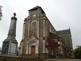
Montbert
| |
|---|---|
Commune | |
 | |
.svg.png.webp) Coat of arms | |
Location of Montbert | |
 Montbert 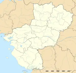 Montbert | |
| Coordinates: 47°03′31″N 1°29′16″W / 47.0586°N 1.4878°W | |
| Country | France |
| Region | Pays de la Loire |
| Department | Loire-Atlantique |
| Arrondissement | Nantes |
| Canton | Saint-Philbert-de-Grand-Lieu |
| Intercommunality | Grand Lieu |
| Government | |
| • Mayor (2020–2026) | Jean-Jacques Mirallié[1] |
| Area 1 | 28.24 km2 (10.90 sq mi) |
| Population | 3,305 |
| • Density | 120/km2 (300/sq mi) |
| Time zone | UTC+01:00 (CET) |
| • Summer (DST) | UTC+02:00 (CEST) |
| INSEE/Postal code | 44102 /44140 |
| Elevation | 7–51 m (23–167 ft) |
| 1 French Land Register data, which excludes lakes, ponds, glaciers > 1 km2 (0.386 sq mi or 247 acres) and river estuaries. | |
Montbert (French pronunciation: [mɔ̃bɛʁ] ⓘ; Gallo: Montebèrt, Breton: Monteverzh) is a commune in the Loire-Atlantique department in western France. In 1954 it ceded part of its territory to the new commune of Geneston.[3]
Population
|
| ||||||||||||||||||||||||||||||||||||||||||||||||||||||
| Source: EHESS[3] and INSEE (1968-2017)[4] | |||||||||||||||||||||||||||||||||||||||||||||||||||||||
See also
References
- ↑ "Répertoire national des élus: les maires" (in French). data.gouv.fr, Plateforme ouverte des données publiques françaises. 13 September 2022.
- ↑ "Populations légales 2021". The National Institute of Statistics and Economic Studies. 28 December 2023.
- 1 2 Des villages de Cassini aux communes d'aujourd'hui: Commune data sheet Montbert, EHESS (in French).
- ↑ Population en historique depuis 1968, INSEE
Wikimedia Commons has media related to Montbert.
This article is issued from Wikipedia. The text is licensed under Creative Commons - Attribution - Sharealike. Additional terms may apply for the media files.