Fesches-le-Châtel | |
|---|---|
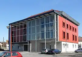 The town hall in Fesches-le-Châtel | |
 Coat of arms | |
Location of Fesches-le-Châtel | |
 Fesches-le-Châtel  Fesches-le-Châtel | |
| Coordinates: 47°31′29″N 6°54′27″E / 47.5247°N 6.9075°E | |
| Country | France |
| Region | Bourgogne-Franche-Comté |
| Department | Doubs |
| Arrondissement | Montbéliard |
| Canton | Bethoncourt |
| Intercommunality | Pays de Montbéliard Agglomération |
| Government | |
| • Mayor (2020–2026) | Charles Demouge[1] |
| Area 1 | 3.46 km2 (1.34 sq mi) |
| Population | 2,164 |
| • Density | 630/km2 (1,600/sq mi) |
| Time zone | UTC+01:00 (CET) |
| • Summer (DST) | UTC+02:00 (CEST) |
| INSEE/Postal code | 25237 /25490 |
| Elevation | 322–403 m (1,056–1,322 ft) |
| 1 French Land Register data, which excludes lakes, ponds, glaciers > 1 km2 (0.386 sq mi or 247 acres) and river estuaries. | |
Fesches-le-Châtel (French pronunciation: [fɛːʃ lə ʃɑtɛl]) is a commune in the Doubs department in the Bourgogne-Franche-Comté region in eastern France.
Population
| Year | Pop. | ±% p.a. |
|---|---|---|
| 1968 | 2,346 | — |
| 1975 | 2,288 | −0.36% |
| 1982 | 2,263 | −0.16% |
| 1990 | 2,118 | −0.82% |
| 1999 | 2,167 | +0.25% |
| 2007 | 2,235 | +0.39% |
| 2012 | 2,261 | +0.23% |
| 2017 | 2,189 | −0.65% |
| Source: INSEE[3] | ||
See also
References
- ↑ "Répertoire national des élus: les maires". data.gouv.fr, Plateforme ouverte des données publiques françaises (in French). 2 December 2020.
- ↑ "Populations légales 2021". The National Institute of Statistics and Economic Studies. 28 December 2023.
- ↑ Population en historique depuis 1968, INSEE
External links
Wikimedia Commons has media related to Fesches-le-Châtel.
- Official website (in French)
This article is issued from Wikipedia. The text is licensed under Creative Commons - Attribution - Sharealike. Additional terms may apply for the media files.