Goux-sous-Landet | |
|---|---|
 Goux-sous-Landet | |
Location of Goux-sous-Landet | |
 Goux-sous-Landet  Goux-sous-Landet | |
| Coordinates: 47°04′52″N 5°56′03″E / 47.0811°N 5.9342°E | |
| Country | France |
| Region | Bourgogne-Franche-Comté |
| Department | Doubs |
| Arrondissement | Besançon |
| Canton | Saint-Vit |
| Government | |
| • Mayor (2020–2026) | Patricia Paquiez-Guyetant[1] |
| Area 1 | 5.42 km2 (2.09 sq mi) |
| Population | 60 |
| • Density | 11/km2 (29/sq mi) |
| Time zone | UTC+01:00 (CET) |
| • Summer (DST) | UTC+02:00 (CEST) |
| INSEE/Postal code | 25283 /25440 |
| Elevation | 377–581 m (1,237–1,906 ft) |
| 1 French Land Register data, which excludes lakes, ponds, glaciers > 1 km2 (0.386 sq mi or 247 acres) and river estuaries. | |
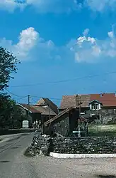
Goux-sous-Landet (French pronunciation: [ɡu su lɑ̃dɛ]) is a commune in the Doubs department in the Bourgogne-Franche-Comté region in eastern France.
It is located on the D110 route, south of Courcelles.
Population
| Year | Pop. | ±% |
|---|---|---|
| 1962 | 46 | — |
| 1968 | 55 | +19.6% |
| 1975 | 54 | −1.8% |
| 1982 | 53 | −1.9% |
| 1990 | 56 | +5.7% |
| 1999 | 42 | −25.0% |
| 2008 | 49 | +16.7% |
| 2012 | 66 | +34.7% |
See also
References
- ↑ "Répertoire national des élus: les maires". data.gouv.fr, Plateforme ouverte des données publiques françaises (in French). 2 December 2020.
- ↑ "Populations légales 2021". The National Institute of Statistics and Economic Studies. 28 December 2023.
Wikimedia Commons has media related to Goux-sous-Landet.
This article is issued from Wikipedia. The text is licensed under Creative Commons - Attribution - Sharealike. Additional terms may apply for the media files.