Roches-lès-Blamont | |
|---|---|
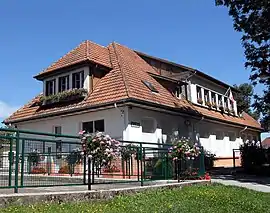 The town hall in Roches-lès-Blamont | |
 Coat of arms | |
Location of Roches-lès-Blamont | |
 Roches-lès-Blamont  Roches-lès-Blamont | |
| Coordinates: 47°24′36″N 6°51′07″E / 47.41°N 6.8519°E | |
| Country | France |
| Region | Bourgogne-Franche-Comté |
| Department | Doubs |
| Arrondissement | Montbéliard |
| Canton | Maîche |
| Intercommunality | Pays de Montbéliard Agglomération |
| Government | |
| • Mayor (2020–2026) | Georges Haberstich[1] |
| Area 1 | 5.44 km2 (2.10 sq mi) |
| Population | 616 |
| • Density | 110/km2 (290/sq mi) |
| Time zone | UTC+01:00 (CET) |
| • Summer (DST) | UTC+02:00 (CEST) |
| INSEE/Postal code | 25497 /25310 |
| Elevation | 417–573 m (1,368–1,880 ft) |
| 1 French Land Register data, which excludes lakes, ponds, glaciers > 1 km2 (0.386 sq mi or 247 acres) and river estuaries. | |
Roches-lès-Blamont (French pronunciation: [ʁɔʃ lɛ blamɔ̃], literally Roches near Blamont) is a commune in the Doubs Department in the Bourgogne-Franche-Comté region in eastern France.
Geography
The commune lies 5 km (3.1 mi) south of Hérimoncourt between Switzerland, the Lomont chain, and the valley of the Doubs.
Population
| Year | Pop. | ±% |
|---|---|---|
| 1962 | 287 | — |
| 1968 | 292 | +1.7% |
| 1975 | 377 | +29.1% |
| 1982 | 493 | +30.8% |
| 1990 | 548 | +11.2% |
| 1999 | 574 | +4.7% |
| 2008 | 643 | +12.0% |
| 2012 | 630 | −2.0% |
See also
References
- ↑ "Répertoire national des élus: les maires" (in French). data.gouv.fr, Plateforme ouverte des données publiques françaises. 13 September 2022.
- ↑ "Populations légales 2021". The National Institute of Statistics and Economic Studies. 28 December 2023.
External links
Wikimedia Commons has media related to Roches-lès-Blamont.
- Roches-lès-Blamont on the regional Web site (in French)
This article is issued from Wikipedia. The text is licensed under Creative Commons - Attribution - Sharealike. Additional terms may apply for the media files.