40°44′46″N 43°47′49″E / 40.74611°N 43.79694°E
Gharibjanyan
Ղարիբջանյան | |
|---|---|
 | |
 Gharibjanyan 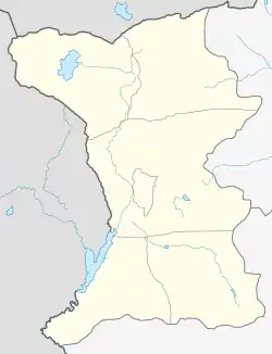 Gharibjanyan | |
| Coordinates: 40°44′46″N 43°47′49″E / 40.74611°N 43.79694°E | |
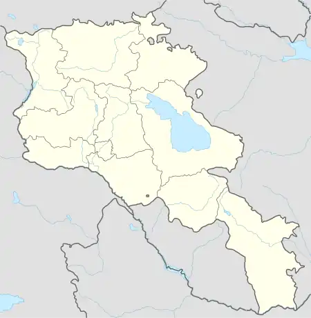
| Country | Armenia |
| Province | Shirak |
| Municipality | Akhuryan |
| Elevation | 1,470 m (4,820 ft) |
| Population (2011) | |
| • Total | 1,055 |
| Time zone | UTC+4 |
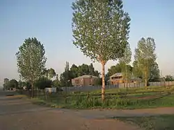
Gharibjanyan (Armenian: Ղարիբջանյան), known as Aleksandrovka until 1935, is a village in the Akhuryan Municipality of the Shirak Province of Armenia. The village was renamed in 1935 in honor of Bolshevik leader Bagrat Gharibjanyan, killed in 1920.[1]
Demographics
The population of the village since 1908 is as follows:<[2]
| Year | Population |
|---|---|
| 1908 | 202 |
| 1926 | 345 |
| 1939 | 539 |
| 1959 | 667 |
| 1970 | 674 |
| 1979 | 595 |
| 1989 | 954 |
| 2001 | 953 |
| 2004 | 954 |
References
- ↑ Kiesling, Brady (June 2000). Rediscovering Armenia: An Archaeological/Touristic Gazetteer and Map Set for the Historical Monuments of Armenia (PDF). Archived (PDF) from the original on 6 November 2021.
- ↑ Հայաստանի Հանրապետության բնակավայրերի բառարան [Republic of Armenia settlements dictionary] (PDF) (in Armenian). Yerevan: Cadastre Committee of the Republic of Armenia. 2008. Archived from the original (PDF) on 11 March 2018.
- Gharibjanyan at GEOnet Names Server
- Report of the results of the 2001 Armenian Census, Statistical Committee of Armenia
Capital: Gyumri | ||
| Urban settlements | 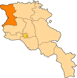 | |
| Akhuryan Municipality | ||
| Amasia Municipality | ||
| Ani Municipality | ||
| Artik Municipality | ||
| Ashotsk Municipality | ||
This article is issued from Wikipedia. The text is licensed under Creative Commons - Attribution - Sharealike. Additional terms may apply for the media files.