Kereki | |
|---|---|
Village | |
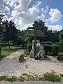
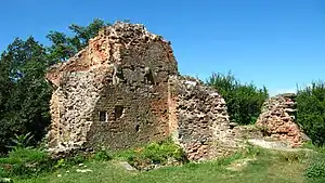   Descending, from top: ruins of Fejérkő Castle above Kereki, fishing pond, scenery on the road to the north | |
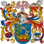
 Coat of arms | |
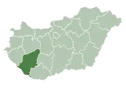
 Kereki Location of Kereki | |
| Coordinates: 46°47′48″N 17°54′44″E / 46.79676°N 17.91215°E | |
| Country | |
| Region | Southern Transdanubia |
| County | Somogy |
| District | Siófok |
| RC Diocese | Kaposvár |
| Area | |
| • Total | 14.43 km2 (5.57 sq mi) |
| Population (2017) | |
| • Total | 534[1] |
| Demonym | Kereki |
| Time zone | UTC+1 (CET) |
| • Summer (DST) | UTC+2 (CEST) |
| Postal code | 8618 |
| Area code | (+36) 84 |
| Patron Saint | Saint Anne |
| Motorways | M7 |
| Distance from Budapest | 125 km (78 mi) Northeast |
| NUTS 3 code | HU232 |
| MP | Mihály Witzmann (Fidesz) |
Gallery

External links
References
Kereki's neighbours | ||||||||||||||||
|---|---|---|---|---|---|---|---|---|---|---|---|---|---|---|---|---|
| ||||||||||||||||
| Towns (3) |
| |
|---|---|---|
| Large village (1) | ||
| Villages (20) | ||
This article is issued from Wikipedia. The text is licensed under Creative Commons - Attribution - Sharealike. Additional terms may apply for the media files.