Szentbalázs | |
|---|---|
Village | |
 View of Szentbalázs | |
 Coat of arms | |
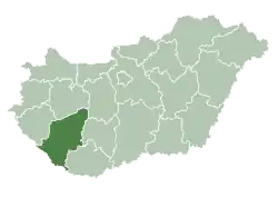
 Szentbalázs Location of Szentbalázs | |
| Coordinates: 46°19′16″N 17°53′49″E / 46.32105°N 17.89682°E | |
| Country | |
| Region | Southern Transdanubia |
| County | Somogy |
| District | Kaposvár |
| RC Diocese | Kaposvár |
| Area | |
| • Total | 12.14 km2 (4.69 sq mi) |
| Population (2017) | |
| • Total | 294[1] |
| Demonym(s) | balázsi, szentbalázsi |
| Time zone | UTC+1 (CET) |
| • Summer (DST) | UTC+2 (CEST) |
| Postal code | 7472 |
| Area code | (+36) 82 |
| Patron Saint | Saint Blaise |
| NUTS 3 code | HU232 |
| MP | Attila Gelencsér (Fidesz) |
| Website | Szentbalázs Online |
History
According to László Szita the settlement was completely Hungarian in the 18th century.[2]
Twin city
External links
References
This article is issued from Wikipedia. The text is licensed under Creative Commons - Attribution - Sharealike. Additional terms may apply for the media files.