Labécède-Lauragais | |
|---|---|
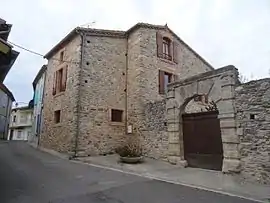 The chateau entrance in Labécède-Lauragais | |
.svg.png.webp) Coat of arms | |
Location of Labécède-Lauragais | |
 Labécède-Lauragais  Labécède-Lauragais | |
| Coordinates: 43°23′33″N 2°00′22″E / 43.3925°N 2.0061°E | |
| Country | France |
| Region | Occitania |
| Department | Aude |
| Arrondissement | Carcassonne |
| Canton | La Malepère à la Montagne Noire |
| Government | |
| • Mayor (2020–2026) | Jean-Francois Pouzadoux[1] |
| Area 1 | 19.96 km2 (7.71 sq mi) |
| Population | 412 |
| • Density | 21/km2 (53/sq mi) |
| Time zone | UTC+01:00 (CET) |
| • Summer (DST) | UTC+02:00 (CEST) |
| INSEE/Postal code | 11181 /11400 |
| Elevation | 230–593 m (755–1,946 ft) (avg. 320 m or 1,050 ft) |
| 1 French Land Register data, which excludes lakes, ponds, glaciers > 1 km2 (0.386 sq mi or 247 acres) and river estuaries. | |
Labécède-Lauragais (French pronunciation: [labesɛd loʁaɡɛ] ⓘ; Occitan: La Beceda) is a commune in the Aude department in southern France.
Population
| Year | Pop. | ±% |
|---|---|---|
| 1962 | 204 | — |
| 1968 | 231 | +13.2% |
| 1975 | 234 | +1.3% |
| 1982 | 279 | +19.2% |
| 1990 | 317 | +13.6% |
| 1999 | 331 | +4.4% |
| 2008 | 381 | +15.1% |
See also
References
- ↑ "Répertoire national des élus: les maires". data.gouv.fr, Plateforme ouverte des données publiques françaises (in French). 9 August 2021.
- ↑ "Populations légales 2021". The National Institute of Statistics and Economic Studies. 28 December 2023.
Wikimedia Commons has media related to Labécède-Lauragais.
This article is issued from Wikipedia. The text is licensed under Creative Commons - Attribution - Sharealike. Additional terms may apply for the media files.