Lavras do Sul | |
|---|---|
Municipality | |
 | |
 Flag  Coat of arms | |
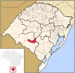 Location in Rio Grande do Sul state | |
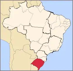
 Lavras do Sul Location in Brazil | |
| Coordinates: 30°48′46″S 53°53′42″W / 30.81278°S 53.89500°W | |
| Country | |
| State | Rio Grande do Sul |
| Meso-region | Sudoeste Rio-Grandense |
| Micro-region | Campanha Meridional |
| Area | |
| • Total | 2,600.60 km2 (1,004.10 sq mi) |
| Population (2020 [1]) | |
| • Total | 7,444 |
| • Density | 2.9/km2 (7.4/sq mi) |
| Time zone | UTC−3 (BRT) |
| Postal code | 97390-xxx |
| Website | www |
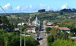
Lavras do Sul is a Brazilian municipality in the southwestern part of the state of Rio Grande do Sul. It is in the Campanha Meridional micro-region and the Sudoeste Rio-Grandense meso-region. The population is 7,444 (2020 est.) in an area of 2600.60 km².[2] The Camaquã River flows through the municipality.
Bounding municipalities
References
External links
- http://www.citybrazil.com.br/rs/lavrasdosul/ (in Portuguese)
Wikimedia Commons has media related to Lavras do Sul.
This article is issued from Wikipedia. The text is licensed under Creative Commons - Attribution - Sharealike. Additional terms may apply for the media files.