Trindade do Sul | |
|---|---|
 Coat of arms | |
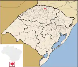 Location in Rio Grande do Sul state | |
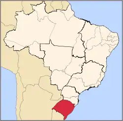
 Trindade do Sul Location in Brazil | |
| Coordinates: 27°31′19″S 52°53′38″W / 27.52194°S 52.89389°W | |
| Country | Brazil |
| Region | South |
| State | Rio Grande do Sul |
| Mesoregion | Noroeste Rio-Grandense |
| Microregion | Frederico Westphalen |
| Founded | December 15, 1987 |
| Government | |
| • Mayor | Luiz da Silva Rosa (PP) |
| Area | |
| • Total | 268.417 km2 (103.636 sq mi) |
| Elevation | 640 m (2,100 ft) |
| Population (2020 [1]) | |
| • Total | 5,791 |
| • Density | 22/km2 (56/sq mi) |
| Demonym | Trindadense |
| Time zone | UTC−3 (BRT) |
| Website | www |
Trindade do Sul is a municipality in the state of Rio Grande do Sul, Brazil.
Geography
The municipality of Trindade do Sul is a part of the Microregion of Frederico Westphalen. It is located at a latitude of 27º31'13" south and a longitude of 52º53'00" west, being at an altitude of 640 meters above sea level.
This municipality is divided in several localities, called lines (Brazilian Portuguese: Linhas). Those are:
- Barra Grande
- Barra Seca
- Barrinha
- Baú
- Bonita
- Cachoeira
- Campina de Pedras
- Passo do Lobo
- Caturrita
- Colônia Nova
- Demétrio
- Filisbina
- Gastão
- Girau
- São Paulo
- São Vicente
- Fátima
- Rincão dos Rosas
- Rossetto
- Assentamento 29 de Outubro
Population
According to IBGE statistics from 2020, Trindade do Sul has a population of 5,791 people.
See also
References
Places adjacent to Trindade do Sul | |
|---|---|
This article is issued from Wikipedia. The text is licensed under Creative Commons - Attribution - Sharealike. Additional terms may apply for the media files.