Manou | |
|---|---|
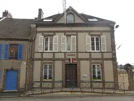 The town hall in Manou | |
Location of Manou | |
 Manou  Manou | |
| Coordinates: 48°31′11″N 0°59′01″E / 48.5197°N 0.9836°E | |
| Country | France |
| Region | Centre-Val de Loire |
| Department | Eure-et-Loir |
| Arrondissement | Nogent-le-Rotrou |
| Canton | Nogent-le-Rotrou |
| Government | |
| • Mayor (2020–2026) | Stéphanie Coutel[1] |
| Area 1 | 13.38 km2 (5.17 sq mi) |
| Population | 599 |
| • Density | 45/km2 (120/sq mi) |
| Time zone | UTC+01:00 (CET) |
| • Summer (DST) | UTC+02:00 (CEST) |
| INSEE/Postal code | 28232 /28240 |
| Elevation | 194–277 m (636–909 ft) (avg. 2,002 m or 6,568 ft) |
| 1 French Land Register data, which excludes lakes, ponds, glaciers > 1 km2 (0.386 sq mi or 247 acres) and river estuaries. | |
Manou (French pronunciation: [manu]) is a commune in the Eure-et-Loir department in northern France.
Population
| Year | Pop. | ±% |
|---|---|---|
| 1962 | 344 | — |
| 1968 | 392 | +14.0% |
| 1975 | 461 | +17.6% |
| 1982 | 474 | +2.8% |
| 1990 | 433 | −8.6% |
| 1999 | 511 | +18.0% |
| 2008 | 564 | +10.4% |
See also
References
- ↑ "Répertoire national des élus: les maires" (in French). data.gouv.fr, Plateforme ouverte des données publiques françaises. 13 September 2022.
- ↑ "Populations légales 2021". The National Institute of Statistics and Economic Studies. 28 December 2023.
Wikimedia Commons has media related to Manou (Eure-et-Loir).
This article is issued from Wikipedia. The text is licensed under Creative Commons - Attribution - Sharealike. Additional terms may apply for the media files.