Montigny-le-Chartif | |
|---|---|
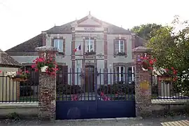 The town hall in Montigny-le-Chartif | |
.svg.png.webp) Coat of arms | |
Location of Montigny-le-Chartif | |
 Montigny-le-Chartif  Montigny-le-Chartif | |
| Coordinates: 48°17′11″N 1°09′19″E / 48.2864°N 1.1553°E | |
| Country | France |
| Region | Centre-Val de Loire |
| Department | Eure-et-Loir |
| Arrondissement | Nogent-le-Rotrou |
| Canton | Brou |
| Government | |
| • Mayor (2020–2026) | Joël Fauquet[1] |
| Area 1 | 25.96 km2 (10.02 sq mi) |
| Population | 593 |
| • Density | 23/km2 (59/sq mi) |
| Time zone | UTC+01:00 (CET) |
| • Summer (DST) | UTC+02:00 (CEST) |
| INSEE/Postal code | 28261 /28120 |
| Elevation | 163–229 m (535–751 ft) |
| 1 French Land Register data, which excludes lakes, ponds, glaciers > 1 km2 (0.386 sq mi or 247 acres) and river estuaries. | |
Montigny-le-Chartif (French pronunciation: [mɔ̃tiɲi lə ʃaʁtif]) is a commune in the Eure-et-Loir department in northern France.
Population
| Year | Pop. | ±% |
|---|---|---|
| 1962 | 588 | — |
| 1968 | 542 | −7.8% |
| 1975 | 525 | −3.1% |
| 1982 | 498 | −5.1% |
| 1990 | 462 | −7.2% |
| 1999 | 453 | −1.9% |
| 2008 | 548 | +21.0% |
See also
References
- ↑ "Répertoire national des élus: les maires". data.gouv.fr, Plateforme ouverte des données publiques françaises (in French). 2 December 2020.
- ↑ "Populations légales 2021". The National Institute of Statistics and Economic Studies. 28 December 2023.
Wikimedia Commons has media related to Montigny-le-Chartif.
This article is issued from Wikipedia. The text is licensed under Creative Commons - Attribution - Sharealike. Additional terms may apply for the media files.