Tenna | |
|---|---|
| Comune di Tenna | |
-Stemma.png.webp) Coat of arms | |
Location of Tenna | |
 Tenna Location of Tenna in Italy 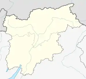 Tenna Tenna (Trentino-Alto Adige/Südtirol) | |
| Coordinates: 46°1′N 11°16′E / 46.017°N 11.267°E | |
| Country | Italy |
| Region | Trentino-Alto Adige/Südtirol |
| Province | Trentino (TN) |
| Area | |
| • Total | 3.1 km2 (1.2 sq mi) |
| Population (Dec. 2004)[2] | |
| • Total | 918 |
| • Density | 300/km2 (770/sq mi) |
| Time zone | UTC+1 (CET) |
| • Summer (DST) | UTC+2 (CEST) |
| Postal code | 38050 |
| Dialing code | 0461 |
| Website | Official website |

the Parish church
Tenna (Téna in local dialect) is a comune (municipality) in Trentino in the northern Italian region Trentino-Alto Adige/Südtirol, located about 13 kilometres (8 mi) southeast of Trento. As of 31 December 2004, it had a population of 918 and an area of 3.1 square kilometres (1.2 sq mi).[3]
Tenna borders the following municipalities: Pergine Valsugana, Levico Terme and Caldonazzo.
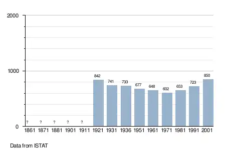
Demographic evolution
References
- ↑ "Superficie di Comuni Province e Regioni italiane al 9 ottobre 2011". Italian National Institute of Statistics. Retrieved 16 March 2019.
- ↑ "Popolazione Residente al 1° Gennaio 2018". Italian National Institute of Statistics. Retrieved 16 March 2019.
- ↑ All demographics and other statistics: Italian statistical institute Istat.
External links
- (in Italian) Homepage of the city
- (in English) Pictures and information about Tenna (Italy)

This article is issued from Wikipedia. The text is licensed under Creative Commons - Attribution - Sharealike. Additional terms may apply for the media files.