Champmillon | |
|---|---|
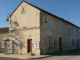 The town hall in Champmillon | |
Location of Champmillon | |
 Champmillon  Champmillon | |
| Coordinates: 45°38′23″N 0°00′02″E / 45.6397°N 0.00056°E | |
| Country | France |
| Region | Nouvelle-Aquitaine |
| Department | Charente |
| Arrondissement | Cognac |
| Canton | Val de Nouère |
| Intercommunality | CA Grand Cognac |
| Government | |
| • Mayor (2020–2026) | Jean-Claude Annonier[1] |
| Area 1 | 9.51 km2 (3.67 sq mi) |
| Population | 516 |
| • Density | 54/km2 (140/sq mi) |
| Time zone | UTC+01:00 (CET) |
| • Summer (DST) | UTC+02:00 (CEST) |
| INSEE/Postal code | 16077 /16290 |
| Elevation | 21–97 m (69–318 ft) (avg. 96 m or 315 ft) |
| 1 French Land Register data, which excludes lakes, ponds, glaciers > 1 km2 (0.386 sq mi or 247 acres) and river estuaries. | |
Champmillon (French pronunciation: [ʃɑ̃mijɔ̃]) is a commune in the Charente department in southwestern France.
Population
| Year | Pop. | ±% p.a. |
|---|---|---|
| 1968 | 302 | — |
| 1975 | 346 | +1.96% |
| 1982 | 358 | +0.49% |
| 1990 | 449 | +2.87% |
| 1999 | 493 | +1.04% |
| 2009 | 524 | +0.61% |
| 2014 | 529 | +0.19% |
| 2020 | 482 | −1.54% |
| Source: INSEE[3] | ||
See also
References
- ↑ "Répertoire national des élus: les maires" (in French). data.gouv.fr, Plateforme ouverte des données publiques françaises. 13 September 2022.
- ↑ "Populations légales 2021". The National Institute of Statistics and Economic Studies. 28 December 2023.
- ↑ Population en historique depuis 1968, INSEE
Wikimedia Commons has media related to Champmillon.
This article is issued from Wikipedia. The text is licensed under Creative Commons - Attribution - Sharealike. Additional terms may apply for the media files.