Crouay | |
|---|---|
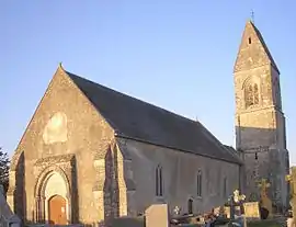 The church in Crouay | |
 Coat of arms | |
Location of Crouay | |
 Crouay  Crouay | |
| Coordinates: 49°16′05″N 0°48′22″W / 49.2681°N 0.8061°W | |
| Country | France |
| Region | Normandy |
| Department | Calvados |
| Arrondissement | Bayeux |
| Canton | Trévières |
| Intercommunality | CC Isigny-Omaha Intercom |
| Government | |
| • Mayor (2020–2026) | Fabienne Leroy[1] |
| Area 1 | 7.73 km2 (2.98 sq mi) |
| Population | 509 |
| • Density | 66/km2 (170/sq mi) |
| Time zone | UTC+01:00 (CET) |
| • Summer (DST) | UTC+02:00 (CEST) |
| INSEE/Postal code | 14209 /14400 |
| Elevation | 24–81 m (79–266 ft) (avg. 44 m or 144 ft) |
| 1 French Land Register data, which excludes lakes, ponds, glaciers > 1 km2 (0.386 sq mi or 247 acres) and river estuaries. | |
Crouay (French pronunciation: [kʁuɛ] ⓘ) is a commune in the Calvados department in the Normandy region in northwestern France.
International relations
Crouay is twinned with Braishfield, United Kingdom.[3]
Population
| Year | Pop. | ±% |
|---|---|---|
| 1962 | 383 | — |
| 1968 | 331 | −13.6% |
| 1975 | 352 | +6.3% |
| 1982 | 397 | +12.8% |
| 1990 | 444 | +11.8% |
| 1999 | 417 | −6.1% |
| 2008 | 529 | +26.9% |
See also
References
- ↑ "Répertoire national des élus: les maires". data.gouv.fr, Plateforme ouverte des données publiques françaises (in French). 9 August 2021.
- ↑ "Populations légales 2021". The National Institute of Statistics and Economic Studies. 28 December 2023.
- ↑ "British towns twinned with French towns". Archant Community Media Ltd. Archived from the original on 5 July 2013. Retrieved 11 July 2013.
Wikimedia Commons has media related to Crouay.
This article is issued from Wikipedia. The text is licensed under Creative Commons - Attribution - Sharealike. Additional terms may apply for the media files.