Saint-Arnoult | |
|---|---|
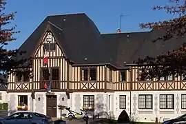 The town hall in Saint-Arnoult | |
.svg.png.webp) Coat of arms | |
Location of Saint-Arnoult | |
 Saint-Arnoult  Saint-Arnoult | |
| Coordinates: 49°20′03″N 0°05′25″E / 49.3342°N 0.0903°E | |
| Country | France |
| Region | Normandy |
| Department | Calvados |
| Arrondissement | Lisieux |
| Canton | Pont-l'Évêque |
| Intercommunality | Cœur Côte Fleurie |
| Government | |
| • Mayor (2020–2026) | François Pédrono[1] |
| Area 1 | 5.12 km2 (1.98 sq mi) |
| Population | 1,105 |
| • Density | 220/km2 (560/sq mi) |
| Time zone | UTC+01:00 (CET) |
| • Summer (DST) | UTC+02:00 (CEST) |
| INSEE/Postal code | 14557 /14800 |
| Elevation | 2–100 m (6.6–328.1 ft) (avg. 30 m or 98 ft) |
| 1 French Land Register data, which excludes lakes, ponds, glaciers > 1 km2 (0.386 sq mi or 247 acres) and river estuaries. | |
Saint-Arnoult (French pronunciation: [sɛ̃.t‿aʁnu] ⓘ) is a commune in the Calvados department, region of Normandy, northwestern France.
Population
| Year | Pop. | ±% |
|---|---|---|
| 1962 | 444 | — |
| 1968 | 523 | +17.8% |
| 1975 | 526 | +0.6% |
| 1982 | 518 | −1.5% |
| 1990 | 766 | +47.9% |
| 1999 | 903 | +17.9% |
| 2008 | 1,099 | +21.7% |
See also
References
- ↑ "Répertoire national des élus: les maires". data.gouv.fr, Plateforme ouverte des données publiques françaises (in French). 2 December 2020.
- ↑ "Populations légales 2021". The National Institute of Statistics and Economic Studies. 28 December 2023.
Wikimedia Commons has media related to Saint-Arnoult (Calvados).
This article is issued from Wikipedia. The text is licensed under Creative Commons - Attribution - Sharealike. Additional terms may apply for the media files.