Souleuvre en Bocage | |
|---|---|
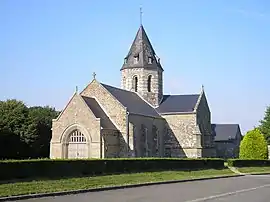 The church in Sainte-Marie-Laumont | |
Location of Souleuvre en Bocage | |
 Souleuvre en Bocage  Souleuvre en Bocage | |
| Coordinates: 48°56′17″N 0°50′31″W / 48.938°N 0.842°W | |
| Country | France |
| Region | Normandy |
| Department | Calvados |
| Arrondissement | Vire |
| Canton | Condé-en-Normandie |
| Intercommunality | Intercom de la Vire au Noireau |
| Area 1 | 187.28 km2 (72.31 sq mi) |
| Population | 8,745 |
| • Density | 47/km2 (120/sq mi) |
| Time zone | UTC+01:00 (CET) |
| • Summer (DST) | UTC+02:00 (CEST) |
| INSEE/Postal code | 14061 /14350 |
| 1 French Land Register data, which excludes lakes, ponds, glaciers > 1 km2 (0.386 sq mi or 247 acres) and river estuaries. | |
Souleuvre en Bocage (French pronunciation: [sulœvʁ ɑ̃ bɔkaʒ], literally Souleuvre in Bocage) is a commune in the department of Calvados, northwestern France. The municipality was established on 1 January 2016 by merger of the former communes of Beaulieu, Le Bény-Bocage (the seat), Bures-les-Monts, Campeaux, Carville, Étouvy, La Ferrière-Harang, La Graverie, Malloué, Montamy, Mont-Bertrand, Montchauvet, Le Reculey, Saint-Denis-Maisoncelles, Sainte-Marie-Laumont, Saint-Martin-des-Besaces, Saint-Martin-Don, Saint-Ouen-des-Besaces, Saint-Pierre-Tarentaine and Le Tourneur.[2]
Population
| Year | Pop. | ±% p.a. |
|---|---|---|
| 1968 | 7,396 | — |
| 1975 | 6,763 | −1.27% |
| 1982 | 6,763 | +0.00% |
| 1990 | 7,030 | +0.49% |
| 1999 | 7,488 | +0.70% |
| 2007 | 8,069 | +0.94% |
| 2012 | 8,593 | +1.27% |
| 2017 | 8,839 | +0.57% |
| Source: INSEE[3] | ||
See also
References
Wikimedia Commons has media related to Souleuvre en Bocage.
- ↑ "Populations légales 2021". The National Institute of Statistics and Economic Studies. 28 December 2023.
- ↑ Arrêté préfectoral 1 December 2015 (in French)
- ↑ Population en historique depuis 1968, INSEE
This article is issued from Wikipedia. The text is licensed under Creative Commons - Attribution - Sharealike. Additional terms may apply for the media files.