Eth | |
|---|---|
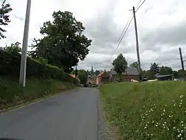 A view within Eth | |
.svg.png.webp) Coat of arms | |
Location of Eth | |
 Eth  Eth | |
| Coordinates: 50°19′36″N 3°40′08″E / 50.3267°N 3.6689°E | |
| Country | France |
| Region | Hauts-de-France |
| Department | Nord |
| Arrondissement | Avesnes-sur-Helpe |
| Canton | Aulnoye-Aymeries |
| Intercommunality | CC Pays de Mormal |
| Government | |
| • Mayor (2020–2026) | Pierrette Guiost[1] |
| Area 1 | 2.84 km2 (1.10 sq mi) |
| Population | 341 |
| • Density | 120/km2 (310/sq mi) |
| Time zone | UTC+01:00 (CET) |
| • Summer (DST) | UTC+02:00 (CEST) |
| INSEE/Postal code | 59217 /59144 |
| Elevation | 59–107 m (194–351 ft) (avg. 87 m or 285 ft) |
| 1 French Land Register data, which excludes lakes, ponds, glaciers > 1 km2 (0.386 sq mi or 247 acres) and river estuaries. | |
Eth (French pronunciation: [ɛt]) is a commune in the Nord department in northern France.[3]
It is about 10 km (6.2 mi) east-southeast of Valenciennes. Residents are called Ethois (feminine plural Ethoises).
Heraldry
Arms of Eth |
The arms of Eth are blazoned : Or, a cross engrailed gules. (Artres, Bettrechies, Cerfontaine, Denain, Eth, Lesquin, Obies, Quérénaing, Semousies, Wambrechies and Warlaing use the same arms.)
|
See also
References
- ↑ "Répertoire national des élus: les maires" (in French). data.gouv.fr, Plateforme ouverte des données publiques françaises. 13 September 2022.
- ↑ "Populations légales 2021". The National Institute of Statistics and Economic Studies. 28 December 2023.
- ↑ INSEE commune file
Wikimedia Commons has media related to Eth (Nord).
This article is issued from Wikipedia. The text is licensed under Creative Commons - Attribution - Sharealike. Additional terms may apply for the media files.