Hornaing | |
|---|---|
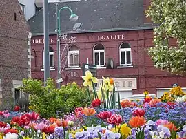 The town hall of Hornaing | |
_Nord-France.svg.png.webp) Coat of arms | |
Location of Hornaing | |
 Hornaing  Hornaing | |
| Coordinates: 50°22′07″N 3°20′10″E / 50.3686°N 3.3361°E | |
| Country | France |
| Region | Hauts-de-France |
| Department | Nord |
| Arrondissement | Douai |
| Canton | Sin-le-Noble |
| Intercommunality | Cœur d'Ostrevent |
| Government | |
| • Mayor (2020–2026) | Frédéric Delannoy[1] |
| Area 1 | 8.95 km2 (3.46 sq mi) |
| Population | 3,535 |
| • Density | 390/km2 (1,000/sq mi) |
| Time zone | UTC+01:00 (CET) |
| • Summer (DST) | UTC+02:00 (CEST) |
| INSEE/Postal code | 59314 /59171 |
| Elevation | 16–45 m (52–148 ft) (avg. 23 m or 75 ft) |
| 1 French Land Register data, which excludes lakes, ponds, glaciers > 1 km2 (0.386 sq mi or 247 acres) and river estuaries. | |
Hornaing (French pronunciation: [ɔʁnɛ̃]) is a commune in the Nord department, northern France.[3]
Population
| Year | Pop. | ±% p.a. |
|---|---|---|
| 1968 | 3,178 | — |
| 1975 | 3,102 | −0.35% |
| 1982 | 2,971 | −0.61% |
| 1990 | 2,931 | −0.17% |
| 1999 | 2,942 | +0.04% |
| 2007 | 3,199 | +1.05% |
| 2012 | 3,571 | +2.22% |
| 2017 | 3,553 | −0.10% |
| Source: INSEE[4] | ||
Heraldry
Arms of Hornaing |
The arms of Hornaing are blazoned : Gules, a fess and in chief a vivre Or. [a vivre is a thin barrulet dancetty] (Gommegnies, Hornaing and Mastaing use the same arms.)
|
See also
References
- ↑ "Répertoire national des élus: les maires" (in French). data.gouv.fr, Plateforme ouverte des données publiques françaises. 13 September 2022.
- ↑ "Populations légales 2021". The National Institute of Statistics and Economic Studies. 28 December 2023.
- ↑ INSEE commune file
- ↑ Population en historique depuis 1968, INSEE
Wikimedia Commons has media related to Hornaing.
This article is issued from Wikipedia. The text is licensed under Creative Commons - Attribution - Sharealike. Additional terms may apply for the media files.