Wallon-Cappel | |
|---|---|
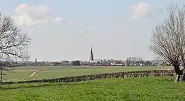 A general view of Wallon-Cappel | |
.svg.png.webp) Coat of arms | |
Location of Wallon-Cappel | |
 Wallon-Cappel  Wallon-Cappel | |
| Coordinates: 50°43′41″N 2°28′27″E / 50.7281°N 2.4742°E | |
| Country | France |
| Region | Hauts-de-France |
| Department | Nord |
| Arrondissement | Dunkerque |
| Canton | Hazebrouck |
| Intercommunality | Flandre Intérieure |
| Government | |
| • Mayor (2020–2026) | Éric Smal[1] |
| Area 1 | 5.44 km2 (2.10 sq mi) |
| Population | 788 |
| • Density | 140/km2 (380/sq mi) |
| Time zone | UTC+01:00 (CET) |
| • Summer (DST) | UTC+02:00 (CEST) |
| INSEE/Postal code | 59634 /59190 |
| Elevation | 30–69 m (98–226 ft) (avg. 43 m or 141 ft) |
| 1 French Land Register data, which excludes lakes, ponds, glaciers > 1 km2 (0.386 sq mi or 247 acres) and river estuaries. | |
Wallon-Cappel (French pronunciation: [walɔ̃ kapɛl]; Dutch: Waalskappel) is a commune in the Nord department in northern France.[3]
Heraldry
Arms of Wallon-Cappel |
The arms of Wallon-Cappel are blazoned : Or, 2 fesses gules.
|
Population
| Year | Pop. | ±% p.a. |
|---|---|---|
| 1968 | 452 | — |
| 1975 | 460 | +0.25% |
| 1982 | 546 | +2.48% |
| 1990 | 653 | +2.26% |
| 1999 | 831 | +2.71% |
| 2007 | 903 | +1.04% |
| 2012 | 869 | −0.76% |
| 2017 | 811 | −1.37% |
| Source: INSEE[4] | ||
See also
References
- ↑ "Répertoire national des élus: les maires". data.gouv.fr, Plateforme ouverte des données publiques françaises (in French). 2 December 2020.
- ↑ "Populations légales 2021". The National Institute of Statistics and Economic Studies. 28 December 2023.
- ↑ INSEE commune file
- ↑ Population en historique depuis 1968, INSEE
External links
Wikimedia Commons has media related to Wallon-Cappel.
This article is issued from Wikipedia. The text is licensed under Creative Commons - Attribution - Sharealike. Additional terms may apply for the media files.