Férin | |
|---|---|
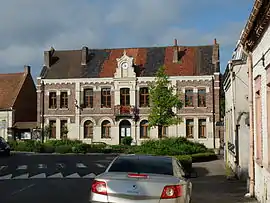 The town hall in Férin | |
.svg.png.webp) Coat of arms | |
Location of Férin | |
 Férin  Férin | |
| Coordinates: 50°19′41″N 3°04′26″E / 50.328°N 3.074°E | |
| Country | France |
| Region | Hauts-de-France |
| Department | Nord |
| Arrondissement | Douai |
| Canton | Aniche |
| Intercommunality | Douaisis Agglo |
| Government | |
| • Mayor (2020–2026) | Michel Pederencino[1] |
| Area 1 | 5.52 km2 (2.13 sq mi) |
| Population | 1,447 |
| • Density | 260/km2 (680/sq mi) |
| Time zone | UTC+01:00 (CET) |
| • Summer (DST) | UTC+02:00 (CEST) |
| INSEE/Postal code | 59228 /59169 |
| Elevation | 27–45 m (89–148 ft) (avg. 34 m or 112 ft) |
| 1 French Land Register data, which excludes lakes, ponds, glaciers > 1 km2 (0.386 sq mi or 247 acres) and river estuaries. | |
Férin (French pronunciation: [feʁɛ̃]) is a commune in the Nord department in northern France.[3]
It is 4 km (2.5 mi) south of Douai.
Heraldry
Arms of Férin |
The arms of Férin are blazoned : Or, an eagle sable dimidiated with Azure semy de lys Or. The latter being France Ancient (Dechy, Férin and Saint-Saulve use the same arms.)
|
See also
References
- ↑ "Répertoire national des élus: les maires" (in French). data.gouv.fr, Plateforme ouverte des données publiques françaises. 13 September 2022.
- ↑ "Populations légales 2021". The National Institute of Statistics and Economic Studies. 28 December 2023.
- ↑ INSEE commune file
Wikimedia Commons has media related to Férin.
This article is issued from Wikipedia. The text is licensed under Creative Commons - Attribution - Sharealike. Additional terms may apply for the media files.