Le Sen | |
|---|---|
 | |
Location of Le Sen | |
 Le Sen  Le Sen | |
| Coordinates: 44°07′39″N 0°29′59″W / 44.1275°N 0.4997°W | |
| Country | France |
| Region | Nouvelle-Aquitaine |
| Department | Landes |
| Arrondissement | Mont-de-Marsan |
| Canton | Haute Lande Armagnac |
| Intercommunality | Cœur Haute Lande |
| Government | |
| • Mayor (2020–2026) | Jean-Pierre Puybaraud[1] |
| Area 1 | 51.1 km2 (19.7 sq mi) |
| Population | 227 |
| • Density | 4.4/km2 (12/sq mi) |
| Time zone | UTC+01:00 (CET) |
| • Summer (DST) | UTC+02:00 (CEST) |
| INSEE/Postal code | 40297 /40420 |
| Elevation | 88–123 m (289–404 ft) (avg. 87 m or 285 ft) |
| 1 French Land Register data, which excludes lakes, ponds, glaciers > 1 km2 (0.386 sq mi or 247 acres) and river estuaries. | |
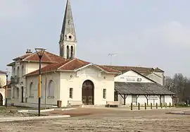
Le Sen is a commune in the Landes department in Nouvelle-Aquitaine in southwestern France.[3]
Population
| Year | Pop. | ±% p.a. |
|---|---|---|
| 1968 | 182 | — |
| 1975 | 127 | −5.01% |
| 1982 | 127 | +0.00% |
| 1990 | 161 | +3.01% |
| 1999 | 201 | +2.50% |
| 2009 | 208 | +0.34% |
| 2014 | 203 | −0.49% |
| 2020 | 233 | +2.32% |
| Source: INSEE[4] | ||
See also
References
- ↑ "Répertoire national des élus: les maires". data.gouv.fr, Plateforme ouverte des données publiques françaises (in French). 9 August 2021.
- ↑ "Populations légales 2021". The National Institute of Statistics and Economic Studies. 28 December 2023.
- ↑ INSEE commune file
- ↑ Population en historique depuis 1968, INSEE
Wikimedia Commons has media related to Le Sen.
This article is issued from Wikipedia. The text is licensed under Creative Commons - Attribution - Sharealike. Additional terms may apply for the media files.