Peyre | |
|---|---|
 | |
Location of Peyre | |
 Peyre  Peyre | |
| Coordinates: 43°34′05″N 0°32′45″W / 43.5681°N 0.5458°W | |
| Country | France |
| Region | Nouvelle-Aquitaine |
| Department | Landes |
| Arrondissement | Mont-de-Marsan |
| Canton | Chalosse Tursan |
| Government | |
| • Mayor (2020–2026) | Chantal Darribère[1] |
| Area 1 | 10.25 km2 (3.96 sq mi) |
| Population | 234 |
| • Density | 23/km2 (59/sq mi) |
| Time zone | UTC+01:00 (CET) |
| • Summer (DST) | UTC+02:00 (CEST) |
| INSEE/Postal code | 40223 /40700 |
| Elevation | 60–156 m (197–512 ft) (avg. 111 m or 364 ft) |
| 1 French Land Register data, which excludes lakes, ponds, glaciers > 1 km2 (0.386 sq mi or 247 acres) and river estuaries. | |
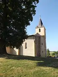
Peyre (French pronunciation: [pɛjʁ]; Occitan: Pèira) is a commune in the Landes department in Nouvelle-Aquitaine in southwestern France.[3]
Population
| Year | Pop. | ±% p.a. |
|---|---|---|
| 1968 | 267 | — |
| 1975 | 221 | −2.67% |
| 1982 | 229 | +0.51% |
| 1990 | 216 | −0.73% |
| 1999 | 223 | +0.35% |
| 2009 | 197 | −1.23% |
| 2014 | 260 | +5.71% |
| 2020 | 230 | −2.02% |
| Source: INSEE[4] | ||
See also
References
- ↑ "Répertoire national des élus: les maires". data.gouv.fr, Plateforme ouverte des données publiques françaises (in French). 2 December 2020.
- ↑ "Populations légales 2021". The National Institute of Statistics and Economic Studies. 28 December 2023.
- ↑ INSEE commune file
- ↑ Population en historique depuis 1968, INSEE
Wikimedia Commons has media related to Peyre (Landes).
This article is issued from Wikipedia. The text is licensed under Creative Commons - Attribution - Sharealike. Additional terms may apply for the media files.