Montigny-Montfort | |
|---|---|
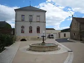 Town hall | |
Location of Montigny-Montfort | |
 Montigny-Montfort  Montigny-Montfort | |
| Coordinates: 47°34′44″N 4°20′43″E / 47.5789°N 4.3453°E | |
| Country | France |
| Region | Bourgogne-Franche-Comté |
| Department | Côte-d'Or |
| Arrondissement | Montbard |
| Canton | Montbard |
| Intercommunality | Montbardois |
| Government | |
| • Mayor (2020–2026) | Claude Jacques[1] |
| Area 1 | 17.13 km2 (6.61 sq mi) |
| Population | 286 |
| • Density | 17/km2 (43/sq mi) |
| Time zone | UTC+01:00 (CET) |
| • Summer (DST) | UTC+02:00 (CEST) |
| INSEE/Postal code | 21429 /21500 |
| Elevation | 227–400 m (745–1,312 ft) (avg. 270 m or 890 ft) |
| 1 French Land Register data, which excludes lakes, ponds, glaciers > 1 km2 (0.386 sq mi or 247 acres) and river estuaries. | |
Montigny-Montfort (French pronunciation: [mɔ̃tiɲi mɔ̃fɔʁ]) is a commune in the Côte-d'Or department in eastern France.
Population
| Year | Pop. | ±% p.a. |
|---|---|---|
| 1968 | 289 | — |
| 1975 | 309 | +0.96% |
| 1982 | 328 | +0.86% |
| 1990 | 318 | −0.39% |
| 1999 | 290 | −1.02% |
| 2009 | 285 | −0.17% |
| 2014 | 307 | +1.50% |
| 2020 | 295 | −0.66% |
| Source: INSEE[3] | ||
See also
References
- ↑ "Répertoire national des élus: les maires". data.gouv.fr, Plateforme ouverte des données publiques françaises (in French). 2 December 2020.
- ↑ "Populations légales 2021". The National Institute of Statistics and Economic Studies. 28 December 2023.
- ↑ Population en historique depuis 1968, INSEE
Wikimedia Commons has media related to Montigny-Montfort.
This article is issued from Wikipedia. The text is licensed under Creative Commons - Attribution - Sharealike. Additional terms may apply for the media files.