Bazougers | |
|---|---|
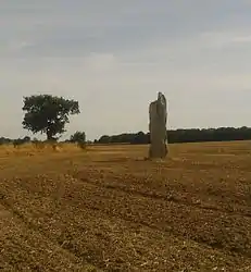 The Menhir de la Hune, in Bazougers | |
.svg.png.webp) Coat of arms | |
Location of Bazougers | |
 Bazougers 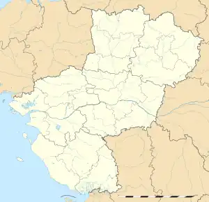 Bazougers | |
| Coordinates: 48°01′02″N 0°34′47″W / 48.0172°N 0.5797°W | |
| Country | France |
| Region | Pays de la Loire |
| Department | Mayenne |
| Arrondissement | Château-Gontier |
| Canton | Meslay-du-Maine |
| Government | |
| • Mayor (2020–2026) | Jérôme Landelle[1] |
| Area 1 | 31.72 km2 (12.25 sq mi) |
| Population | 1,092 |
| • Density | 34/km2 (89/sq mi) |
| Time zone | UTC+01:00 (CET) |
| • Summer (DST) | UTC+02:00 (CEST) |
| INSEE/Postal code | 53025 /53170 |
| Elevation | 52–108 m (171–354 ft) (avg. 83 m or 272 ft) |
| 1 French Land Register data, which excludes lakes, ponds, glaciers > 1 km2 (0.386 sq mi or 247 acres) and river estuaries. | |
Bazougers (French pronunciation: [bazuʒe]) is a commune in the Mayenne department in northwestern France.
Population
| Year | Pop. | ±% p.a. |
|---|---|---|
| 1968 | 781 | — |
| 1975 | 743 | −0.71% |
| 1982 | 864 | +2.18% |
| 1990 | 869 | +0.07% |
| 1999 | 933 | +0.79% |
| 2009 | 999 | +0.69% |
| 2014 | 1,146 | +2.78% |
| 2020 | 1,095 | −0.76% |
| Source: INSEE[3] | ||
See also
References
- ↑ "Répertoire national des élus: les maires" (in French). data.gouv.fr, Plateforme ouverte des données publiques françaises. 13 September 2022.
- ↑ "Populations légales 2021". The National Institute of Statistics and Economic Studies. 28 December 2023.
- ↑ Population en historique depuis 1968, INSEE
Wikimedia Commons has media related to Bazougers.
This article is issued from Wikipedia. The text is licensed under Creative Commons - Attribution - Sharealike. Additional terms may apply for the media files.