Saint-Pierre-la-Cour | |
|---|---|
Location of Saint-Pierre-la-Cour | |
 Saint-Pierre-la-Cour 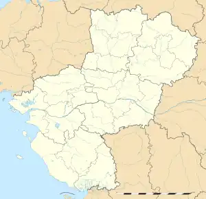 Saint-Pierre-la-Cour | |
| Coordinates: 48°06′56″N 1°01′29″W / 48.1156°N 1.0247°W | |
| Country | France |
| Region | Pays de la Loire |
| Department | Mayenne |
| Arrondissement | Laval |
| Canton | Loiron-Ruillé |
| Intercommunality | Laval Agglomération |
| Government | |
| • Mayor (2020–2026) | Michel Paillard[1] |
| Area 1 | 15.69 km2 (6.06 sq mi) |
| Population | 2,306 |
| • Density | 150/km2 (380/sq mi) |
| Time zone | UTC+01:00 (CET) |
| • Summer (DST) | UTC+02:00 (CEST) |
| INSEE/Postal code | 53247 /53410 |
| Elevation | 93–168 m (305–551 ft) (avg. 96 m or 315 ft) |
| 1 French Land Register data, which excludes lakes, ponds, glaciers > 1 km2 (0.386 sq mi or 247 acres) and river estuaries. | |
Saint-Pierre-la-Cour (French pronunciation: [sɛ̃ pjɛʁ la kuʁ]) is a commune, in the Mayenne department in the north-western of France.[3]
Population
| Year | Pop. | ±% p.a. |
|---|---|---|
| 1968 | 1,750 | — |
| 1975 | 1,782 | +0.26% |
| 1982 | 1,668 | −0.94% |
| 1990 | 1,622 | −0.35% |
| 1999 | 1,638 | +0.11% |
| 2007 | 1,843 | +1.48% |
| 2012 | 2,046 | +2.11% |
| 2017 | 2,170 | +1.18% |
| Source: INSEE[4] | ||
See also
References
- ↑ "Répertoire national des élus: les maires". data.gouv.fr, Plateforme ouverte des données publiques françaises (in French). 2 December 2020.
- ↑ "Populations légales 2021". The National Institute of Statistics and Economic Studies. 28 December 2023.
- ↑ INSEE commune file
- ↑ Population en historique depuis 1968, INSEE
Wikimedia Commons has media related to Saint-Pierre-la-Cour.
This article is issued from Wikipedia. The text is licensed under Creative Commons - Attribution - Sharealike. Additional terms may apply for the media files.