La Selle-Craonnaise | |
|---|---|
 Coat of arms | |
Location of La Selle-Craonnaise | |
 La Selle-Craonnaise 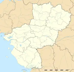 La Selle-Craonnaise | |
| Coordinates: 47°50′37″N 1°02′28″W / 47.8436°N 1.0411°W | |
| Country | France |
| Region | Pays de la Loire |
| Department | Mayenne |
| Arrondissement | Château-Gontier |
| Canton | Cossé-le-Vivien |
| Government | |
| • Mayor (2020–2026) | Joseph Jugé[1] |
| Area 1 | 29.17 km2 (11.26 sq mi) |
| Population | 905 |
| • Density | 31/km2 (80/sq mi) |
| Time zone | UTC+01:00 (CET) |
| • Summer (DST) | UTC+02:00 (CEST) |
| INSEE/Postal code | 53258 /53800 |
| Elevation | 41–107 m (135–351 ft) (avg. 60 m or 200 ft) |
| 1 French Land Register data, which excludes lakes, ponds, glaciers > 1 km2 (0.386 sq mi or 247 acres) and river estuaries. | |
La Selle-Craonnaise (French pronunciation: [la sɛl kʁanɛz]) is a commune in the Mayenne department in north-western France.
Sights
- Church of Saint-Martin, 12th century to 19th century.
- 17th century Castle Saint-Amadour and its park.
- Pond of the Rincerie, leisure center.
See also
References
- ↑ "Répertoire national des élus: les maires". data.gouv.fr, Plateforme ouverte des données publiques françaises (in French). 2 December 2020.
- ↑ "Populations légales 2021". The National Institute of Statistics and Economic Studies. 28 December 2023.
Wikimedia Commons has media related to La Selle-Craonnaise.
This article is issued from Wikipedia. The text is licensed under Creative Commons - Attribution - Sharealike. Additional terms may apply for the media files.