Chéry-lès-Pouilly | |
|---|---|
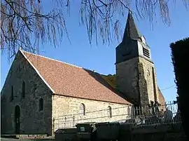 The church of Chéry-lès-Pouilly | |
.svg.png.webp) Coat of arms | |
Location of Chéry-lès-Pouilly | |
 Chéry-lès-Pouilly  Chéry-lès-Pouilly | |
| Coordinates: 49°39′30″N 3°36′22″E / 49.6583°N 3.6061°E | |
| Country | France |
| Region | Hauts-de-France |
| Department | Aisne |
| Arrondissement | Laon |
| Canton | Marle |
| Intercommunality | Pays de la Serre |
| Government | |
| • Mayor (2020–2026) | Éric Bochet[1] |
| Area 1 | 17.22 km2 (6.65 sq mi) |
| Population | 736 |
| • Density | 43/km2 (110/sq mi) |
| Time zone | UTC+01:00 (CET) |
| • Summer (DST) | UTC+02:00 (CEST) |
| INSEE/Postal code | 02180 /02000 |
| Elevation | 59–116 m (194–381 ft) (avg. 76 m or 249 ft) |
| 1 French Land Register data, which excludes lakes, ponds, glaciers > 1 km2 (0.386 sq mi or 247 acres) and river estuaries. | |
Chéry-lès-Pouilly is a commune in the Aisne department in Hauts-de-France in northern France.
Population
| Year | Pop. | ±% p.a. |
|---|---|---|
| 1968 | 633 | — |
| 1975 | 605 | −0.64% |
| 1982 | 702 | +2.15% |
| 1990 | 702 | +0.00% |
| 1999 | 645 | −0.94% |
| 2007 | 660 | +0.29% |
| 2012 | 683 | +0.69% |
| 2017 | 710 | +0.78% |
| Source: INSEE[3] | ||
See also
References
- ↑ "Répertoire national des élus: les maires". data.gouv.fr, Plateforme ouverte des données publiques françaises (in French). 2 December 2020.
- ↑ "Populations légales 2021". The National Institute of Statistics and Economic Studies. 28 December 2023.
- ↑ Population en historique depuis 1968, INSEE
Wikimedia Commons has media related to Chéry-lès-Pouilly.
This article is issued from Wikipedia. The text is licensed under Creative Commons - Attribution - Sharealike. Additional terms may apply for the media files.