Rocourt-Saint-Martin | |
|---|---|
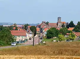 A general view of Rocourt-Saint-Martin | |
Location of Rocourt-Saint-Martin | |
 Rocourt-Saint-Martin  Rocourt-Saint-Martin | |
| Coordinates: 49°09′09″N 3°23′17″E / 49.1525°N 3.3881°E | |
| Country | France |
| Region | Hauts-de-France |
| Department | Aisne |
| Arrondissement | Château-Thierry |
| Canton | Château-Thierry |
| Intercommunality | CA Région de Château-Thierry |
| Government | |
| • Mayor (2020–2026) | Yves Leveque[1] |
| Area 1 | 5.76 km2 (2.22 sq mi) |
| Population | 311 |
| • Density | 54/km2 (140/sq mi) |
| Time zone | UTC+01:00 (CET) |
| • Summer (DST) | UTC+02:00 (CEST) |
| INSEE/Postal code | 02649 /02210 |
| Elevation | 109–212 m (358–696 ft) (avg. 135 m or 443 ft) |
| 1 French Land Register data, which excludes lakes, ponds, glaciers > 1 km2 (0.386 sq mi or 247 acres) and river estuaries. | |
Rocourt-Saint-Martin (French pronunciation: [ʁɔkuʁ sɛ̃ maʁtɛ̃]) is a commune in the Aisne department in Hauts-de-France in northern France.
Population
| Year | Pop. | ±% |
|---|---|---|
| 1962 | 213 | — |
| 1968 | 228 | +7.0% |
| 1975 | 190 | −16.7% |
| 1982 | 175 | −7.9% |
| 1990 | 284 | +62.3% |
| 1999 | 295 | +3.9% |
| 2008 | 314 | +6.4% |
See also
References
- ↑ "Répertoire national des élus: les maires". data.gouv.fr, Plateforme ouverte des données publiques françaises (in French). 2 December 2020.
- ↑ "Populations légales 2021". The National Institute of Statistics and Economic Studies. 28 December 2023.
Wikimedia Commons has media related to Rocourt-Saint-Martin.
This article is issued from Wikipedia. The text is licensed under Creative Commons - Attribution - Sharealike. Additional terms may apply for the media files.