Licy-Clignon | |
|---|---|
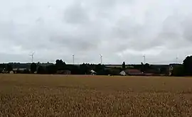 The wind farm of Ourcq and Clignon | |
Location of Licy-Clignon | |
 Licy-Clignon  Licy-Clignon | |
| Coordinates: 49°06′03″N 3°16′29″E / 49.1008°N 3.2747°E | |
| Country | France |
| Region | Hauts-de-France |
| Department | Aisne |
| Arrondissement | Château-Thierry |
| Canton | Villers-Cotterêts |
| Intercommunality | CA Région de Château-Thierry |
| Government | |
| • Mayor (2020–2026) | Jean-Étienne Juillet[1] |
| Area 1 | 4.09 km2 (1.58 sq mi) |
| Population | 74 |
| • Density | 18/km2 (47/sq mi) |
| Time zone | UTC+01:00 (CET) |
| • Summer (DST) | UTC+02:00 (CEST) |
| INSEE/Postal code | 02428 /02810 |
| Elevation | 80–165 m (262–541 ft) (avg. 91 m or 299 ft) |
| 1 French Land Register data, which excludes lakes, ponds, glaciers > 1 km2 (0.386 sq mi or 247 acres) and river estuaries. | |
Licy-Clignon (French pronunciation: [lisi kliɲɔ̃]) is a commune in the Aisne department in Hauts-de-France in northern France.
Population
| Year | Pop. | ±% |
|---|---|---|
| 1962 | 67 | — |
| 1968 | 40 | −40.3% |
| 1975 | 41 | +2.5% |
| 1982 | 42 | +2.4% |
| 1990 | 63 | +50.0% |
| 1999 | 80 | +27.0% |
| 2008 | 90 | +12.5% |
See also
References
- ↑ "Répertoire national des élus: les maires". data.gouv.fr, Plateforme ouverte des données publiques françaises (in French). 2 December 2020.
- ↑ "Populations légales 2021". The National Institute of Statistics and Economic Studies. 28 December 2023.
Wikimedia Commons has media related to Licy-Clignon.
This article is issued from Wikipedia. The text is licensed under Creative Commons - Attribution - Sharealike. Additional terms may apply for the media files.