Druelle Balsac | |
|---|---|
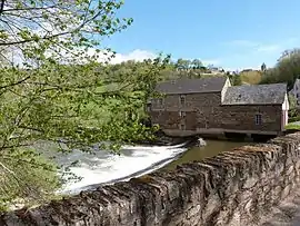 The mill on the Aveyron river, in the hamlet of Les Planques | |
Location of Druelle Balsac | |
 Druelle Balsac  Druelle Balsac | |
| Coordinates: 44°20′42″N 2°29′35″E / 44.345°N 2.493°E | |
| Country | France |
| Region | Occitania |
| Department | Aveyron |
| Arrondissement | Rodez |
| Canton | Vallon |
| Intercommunality | Rodez Agglomération |
| Area 1 | 51.25 km2 (19.79 sq mi) |
| Population | 3,188 |
| • Density | 62/km2 (160/sq mi) |
| Time zone | UTC+01:00 (CET) |
| • Summer (DST) | UTC+02:00 (CEST) |
| INSEE/Postal code | 12090 /12000, 12510 |
| 1 French Land Register data, which excludes lakes, ponds, glaciers > 1 km2 (0.386 sq mi or 247 acres) and river estuaries. | |
Druelle Balsac (French pronunciation: [dʁyɛl balsak]; Occitan: Druèla e Balsac) is a commune in the department of Aveyron, southern France. The municipality was established on 1 January 2017 by merger of the former communes of Druelle (the seat) and Balsac.[2]
Population
| Year | Pop. | ±% p.a. |
|---|---|---|
| 1968 | 1,233 | — |
| 1975 | 1,305 | +0.81% |
| 1982 | 1,628 | +3.21% |
| 1990 | 1,831 | +1.48% |
| 1999 | 2,186 | +1.99% |
| 2007 | 2,511 | +1.75% |
| 2012 | 2,634 | +0.96% |
| 2017 | 3,143 | +3.60% |
| Source: INSEE[3] | ||
See also
References
Wikimedia Commons has media related to Druelle Balsac.
- ↑ "Populations légales 2021". The National Institute of Statistics and Economic Studies. 28 December 2023.
- ↑ Arrêté préfectoral 6 September 2016 (in French)
- ↑ Population en historique depuis 1968, INSEE
This article is issued from Wikipedia. The text is licensed under Creative Commons - Attribution - Sharealike. Additional terms may apply for the media files.